Some essays on design in NYC

Guidemaps - Study Tour handouts
5S naborhood, SoHo, MidTown, Madison & Union Squares
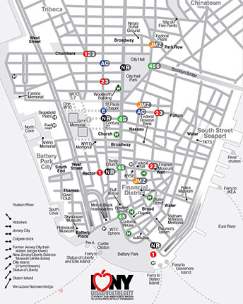

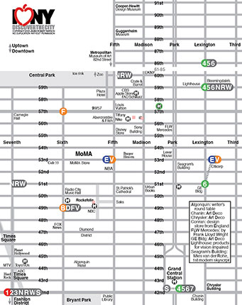
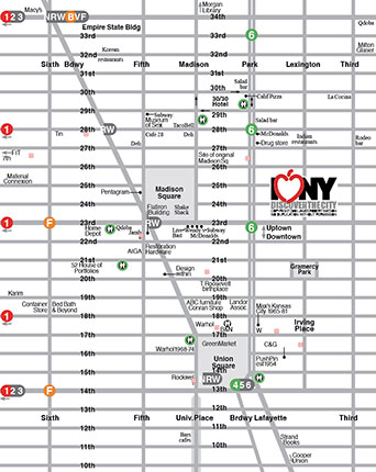
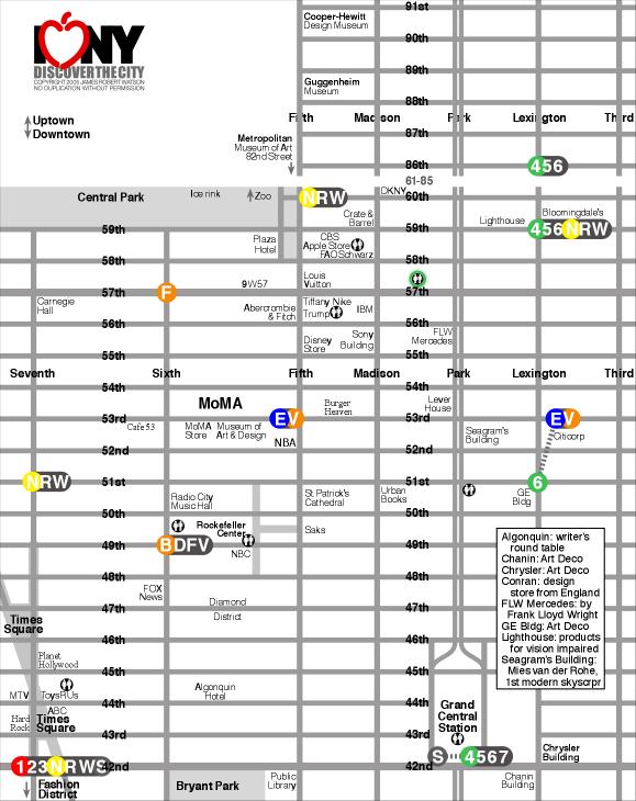
The unusual angled plot line of the Chrysler Building
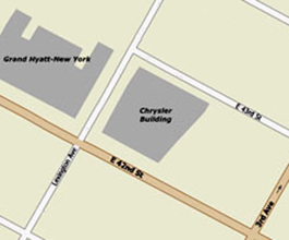
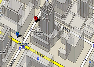
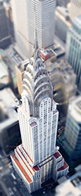
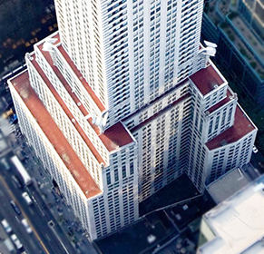
As shown in maps and satellite views, the footprint of the Chrysler Building in Manhattan has an unusual angle on its eastern boundary that doesn't respect the alignment of the street grid. Most people I've asked aren't even aware of the angle and those that are aware do not know why that side of the building is at an angle.
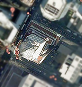
A likely explanation
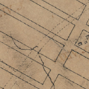
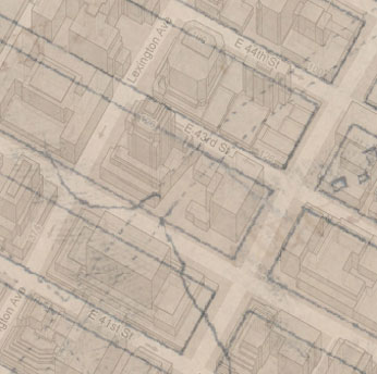
The old map below shows a country road angling right where the Chrysler Building would later be built. I contacted Christopher Gray, the Streetscapes columnist for The New York Times - he confirmed that the country road was the old Boston Post Road, which snaked up the east side, mostly between Third and Second Avenues and led to Boston. Along this road was carried news of the Declaration of Independence. Over time, the city transferred the title of the roadbeds to buyers - the lines up the east side are erratic and do not always appear block to block. When I overlaid the map showing the Chrysler Building with the older map - it was a perfect match that explains the odd angle on the side of the building.
A better Statue of Liberty Visitor Center experience

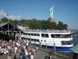
Visiting the Statue of Liberty is one of the most popular visitor experiences in New York City. Since 9/11 and the implementation of heightened security procedures, there hasn't been a great way to manage and educate the crowds of visitors. A tent was set up to contain the security scanners, but the long line of people queues up outside in Battery Park. Tickets are sold at a separate nearby site - the old Castle Clinton historic site. But, a better solution has been sitting in Battery Park for many years.
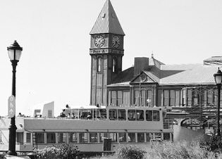

Pier A, the only remaining Victorian-era pier along the Hudson River, can be repurposed as the home for the Statue of Liberty experience: selling tickets, queue line, security scanners, historic exhibits, boat boarding, and souvenirs and food service.
Imagine the complete immersive immigration experience - it starts as the guest approaches Pier A and sees the period architecture. Inside are a foyer of ticket booths, stairs, escalators, and elevators to the second floor. Up on that level are exhibits and the security checkpoint, more exhibits, and a crowd waiting area replicated to imitate the immigrant experience. The boarding area is patterned after European docks of the 1920s. The interior design conveys the crowded sense of waiting to board a ship for the New World. Two or three gangway boarding walkways extend to the second level of the ferries. This allows simultaneous boat exit and entry - guests exit the boats on the lower level and enter the boats on the upper level (where most guests end up, anyway) - this will speed up the transfer of visitors.
The ferries then sail across the harbor to the sight of the statue, just as many immigrants experienced her. The boat vessel has a mutimedia presentation to recreate an immigrant's voyage and arrival. There could be large screens playing videos of recreated immigrant boarding and sailing scenes. Then when in view, the screens could give way to the actual view of the Statue in the harbor - just as immigrants caught a glimpse of it. Then on to Ellis Island. The debarkation docks on Ellis and Liberty Islands continue the period look. Another sight is the Jersey City train station where most immigrants arrived by ferry from Ellis Island and caught a train to a new life in Chicago, Cleveland, St. Louis, and up and down the east coast. Upon the return voyage and debarking the boat, the guests exit down a wide gangplank and through the first floor of Pier A where there are gift and food kiosks, seating, and views of the harbor. The enhanced experience turns the Statue visit into an event, a show worthy of the half-day time requirement.
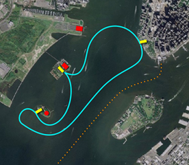
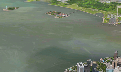
Routes of the ferries from Pier A to Ellis and Liberty Islands. Pier A is at the tip of Manhattan in the upper right. The red dots are, from top to bottom, the Jersey City Train Station, Ellis Island and the Immigration Museum, and the Statue of Liberty. The orange dotted line is the route of the Staten Island Ferry.
Right: Pier A is the light blue dot in the lower right.


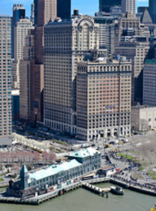
The building: Pier A, the Statue of Liberty Visitor's Center


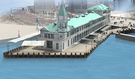
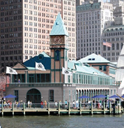


Entry plaza has ample space for crowds without compromising Battery Park. Below: Great landmark visibility.


Advantages to the Pier A Plaza Visitor Center
• Pier A allows the entire mainland experience to be consolidated in one embarkation and exhibit building, providing a landmark identity.
• A larger, more visible, entry plaza on Battery Place allows easier traffic flow of visitors from buses, taxis, and subways.
• Moving the ticket booth out of Castle Clinton frees it up for historical exhibits, a more appropriate and respectful use of that building.
• Battery Park is rid of the temporary white tents and tacky crowd barricades.
• More of the Battery Park river walkway is opened up for better vistas of the harbor.
• Security checks can be conducted in a more secure and less obtrusive environment.
• The queue line is indoors, out of the weather elements. Videos and exhibits can occupy the attention of those in line.
• Space for immigration/Statue exhibits is provided for waiting visitors and for the many people who choose not to visit the statue or arrive too late to get a ferry ticket.
• Two-level loading and unloading speeds up the process and shortens visitor waits.
• Space is provided for vendors of food and souvenirs, protected from the elements.
• A landmark for the experience is visible from along West Street, Battery Place, and Battery Park. A miniature Statue on the top of the flagpole on the Pier A roof provides a strong and familiar visual reference.
• The cohesive continuity of buildings: Liberty Island, Ellis Island, Jersey City Train Station, and the new Pier A Visitor's Center become major components of a comprehensive Immigration Experience.
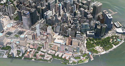
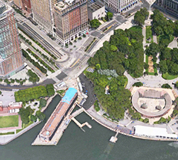
Pier A juts into the bay on the lower right (blue roof), 9/11 Memorial is left center, Staten Island Ferry is right center.


Enhanced visibility at the edge of Battery Park and at the foot of West Street that runs up the Hudson side of Manhattan. The WTC and 9/11 Memorial are a few blocks away.
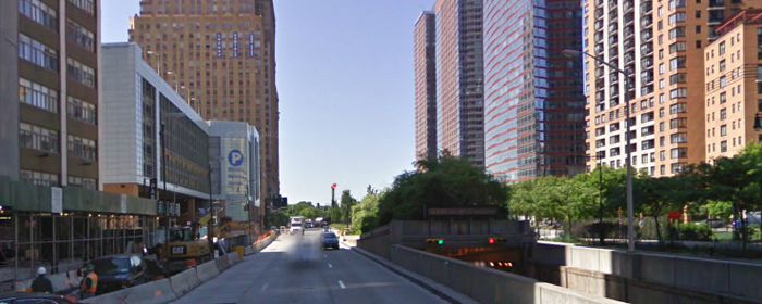
Idea and sketches: 2009. Presentation: 2013
Other options for Pier A
• LoMa Museum Downtown, or Lower Manhattan, needs a comprehensive history museum. The most historical part of the metro area is within a few blocks of Pier A: early Hudson shipping and piers, Battery Park, early naborhoods, Castle Clinton, Statue of Liberty, Governor's Island, Customs House, Bowling Green, World Trade Center, City Hall, Park Row, Woolworth Building, Wall Street, Fraunces Tavern, Stone Street, Delmonico's, and many more significant sights. Pier A is well located to serve as a starting point to explore downtown.
• Visitor's Center: Ticket Booths, Restaurants, and Gift Shops. In the front section could be ferry tickets, harbor cruise tickets, the TKTS booth (move from the Seaport or add a third location). The second floor with its great views of the harbor could accommodate at least two restaurants. The entry level could contain gift shops to take advantage of the mass amounts of tourists.
CityGuides NYC
I often see people looking at maps, looking at street signs, or just looking lost. I will go ask them if I can help them find something. I have yet to be stumped. In my naberhood there are many questions about the World Trade Center and how to get there - I guide them there and tell them about the exhibits and models of the memorial and new office towers that are on display. I guide people to subway lines, Brooklyn, Times Square, Little Italy, etc. Someone pointed out (while waiting on me to help some lost folks) that it is the teacher in me, wanting to help and guide people. I also wonder if it is the training I got for 4 summers while working at Six Flags to help guests. Whatever, I enjoy it. I want these tourists/visitors to have a good experience in New York and to not think all New Yorkers are abrupt and rude (I don't let on that I'm not really a New Yorker)
Saturday, July 29, 2006, I walked downtown to get a haircut. I saw some people with a map. I offered to help and guided them to the WTC site. While talking to them, several others gathered and waited patiently in line. They then asked for directions. I guided them also. Others sought a good place for breakfast (we happened to be standing near a place where I had breakfast with my brother just a few days earlier). So, there is apparently a real need for guides around the city to help the lost and confused. Some naberhoods address this with naborhood Alliance volunteers. But its not enough. I propose CityGuides that are trained, equipped, and visible to provide a valuable guide service.
The concept
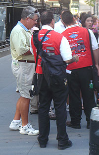
Volunteers, each with a pack of maps, a marker, and literature of naberhood. They are dressed to stand out - a vest, hat, or pennant. They proactively seek lost people. Each also has a cell phone to a base attendant with adequate literature and maps to can answer almost any question.
Objective
The purpose would be to enhance tourism experience. Help visitors have a more positive experience while visiting NYC.
Implementation
1. Volunteers
2. Packs of info
3. Cell to answer source
4. Coordinating agency to oversee volunteer schedule, resource. Could partner or use the naberhood alliances.
5. Stand-out uniform (example to the left of a Gray Line Guide) showing colorful vest, pack of info and cell phone.
Locations
Volunteers would be, not just at these locations, but out on the sidewalks, roaming the naberhoods, near subway stops, busy tourist sights, and major street intersections; seeking and helping. Some sample area coordinating locations:
• Booth in City Hall Park: downtown west, WTC site, Broadway
• South St. Seaport: downtown east
• Castle Clinton: downtown south
• Fashion Center Kiosk: midtown west
• Times Square Info Center: Times Square
• Metropolitan Museum of Art: Fifth Avenue, Museum mile
• Time Warner/Lincoln Center: West side, Dakota, Central Park
Sunny afternoons at Coney Island August 2006 and August 2012
Coney Island was the birthplace of the American amusement park, the modern roller coaster, the looping roller coaster, the dark ride and even the hot dog! It was named by Dutch settlers in the 1600s for the rabbits that inhabited the island - the Dutch word for rabbits is conies).
New Yorkers started visiting Coney Island via a shell road during the 1830's and by the Civil War there were over a dozen hotels and bathhouses on the island. The Golden Age of Coney came with the opening of the first amusement park in 1885 and lasted until about 1910 when horse racing was outlawed. Billed as the "World's Largest Playground", it was popular for the middle and upper classes to get away from the city to the resort-like atmosphere with clubs, restaurants, theaters, and amusements for the whole family. A seedier element was also attracted to the island (it really was an island at first but the separating channel of water was filled in) since the politicians looked the other way when it came to enforcing prostitution, gambling, and alcohol. That, movies, and the automobile (that allowed people to go farther away from the city) all helped turned the tide and Coney Island began a downward spiral. There are plans to revitalize the area today. The Minor League Cyclones play in a new stadium on the site of an old amusement park, AstroLand park is full of new rides, and the Cyclone and Parachute Jump are still landmarks.
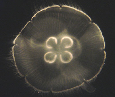
In August, 2006, I was finishing up a summer in New York City. I wanted to go to the beach and experience the historical Coney Island. I rode the subway from downtown Manhattan and, on the train, read a newspaper so I wouldn't look quite like the old geek that I was - heading for a day at the amusement park. Reading the paper didn't seem to fool anyone. About halfway thru the journey, the train rises up out of the ground and travels in a depressed culvert and then up onto elevated tracks as it nears the ocean communities around Brighton Beach. There the tall apartment buildings had surface parking lots in front of them - something I hadn't seen for a while - ample parking lots. I got a glimpse of the ocean - pretty cool. Then disembarked at the NY Aquarium. I walked on an elevated walkway over Surf Avenue (the main Coney drag) and down to the aquarium entrance. Underneath the walkway someone was mowing the grass. Grass. Mowing. I had grown up smelling cut grass every summer of my life. This was the first time for this summer - it smelled great. It brought back memories and reminded me that I would be heading to Oklahoma grass in 2 days. The Aquarium was pretty neat. There were school bus loads of screaming kids. I don't know why they scream. Maybe they have buds in their ears with music blaring so often that, even when there is no ear piece, they still scream. Maybe fighting to be heard. I don't know, but they were loud. When I saw a herd of yelling kids wearing identical tee-shirts, I knew it was time to go to another exhibit. Saw the sea lion show, sharks, and typical fish stuff. Most fascinating: the seahorses with some males bloatedly pregnant (yes, the males carry 300-400 seaponies in them - I don't know what those females must have done or threatened to make that happen. None of the males looked happy; the females were having a good time) and the jellyfish. These creatures astound me with their delicate tentacles and pulsating blobby heads/bodies.
Lunch was at Nathan's Original with the best hot dog I have ever had. Granted, I was hungry and I had been anticipating a Nathan's Coney Island hot dog for about a week. Then, I walked down into the ocean. Yeeha, it was cold. Shivering, take-your-breath-away cold when you dunked under. But refreshing (it was hot at the aquarium and at Nathan's) and delightful to be in the ocean in New York City. Then I strolled the amusement parks and went into the Coney Island Museum where a photo shoot of side show freaks was going on. One sultry looking woman had a large albino boa (snake, not a scarf) draped around her shoulders and arms. I moved on. After about 5 hours of the Coney, I headed back to the train and the ride home to a shower and rest. But a great day.
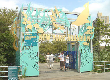

I started the day at the New York Aquarium, part of the Wildlife Conservancy Society along with the area zoos, dedicated to preservation, education, and conservation. The seal show was typical but still a hoot.



Lunch was at Nathan's Original hot dog stand. Nathan worked for Feltman's restaurant where the hot dog was invented about a block over during the early 1900s and sold for a dime. Nathan sold his for a nickel. The public was suspicious so he heavily gimmicked and promoted and finally it became a legend. On the right: My lunch - it was absolutely wonderful.

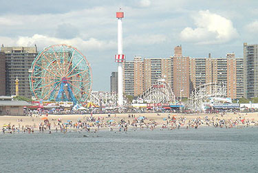
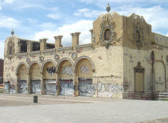
There are still a couple of amusement parks operating along the boardwalk. One of the few remaining structures from the heyday. Most buildings were wood and they were consumed by one of several fires that devastated the night clubs, restaurants, and amusements.


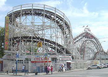
The Cyclone, the first successful roller coaster, was built in 1927 and hits speeds of 68 mph.
From a vintage postcard from the 1950s judging from the cars. From August, 2006.

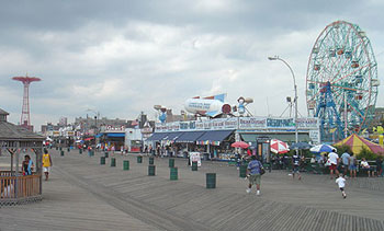
The tall tower is the Parachute Jump which was moved here from the NY World's Fair of 1939-40 but closed in 1964. The Wonder Wheel opened in 1920 and, like the Cyclone coaster, is still operating today.


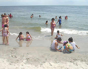
The boardwalk, the beach, and the ocean.

2012: It was time to return to the ocean. I only waded. But, that's because I was protecting my iPhone - I didn't want it out of my pocket and I didn't want my pocket to get wet.
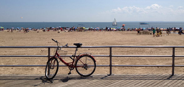


I also watched people riding new rides at Luna Park, some rides I hadn't seen before. The Cyclone coaster (above) is still there.
Of course, I had to go to Nathan's, but, this time, instead of the famous hot dog, I got a crab roll - a crab salad on a warm buttered bun. It was excellent!
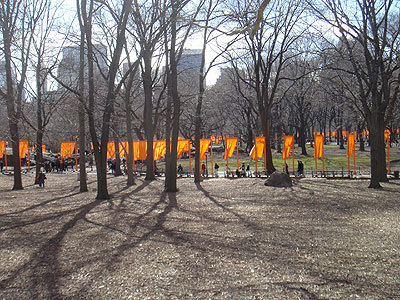
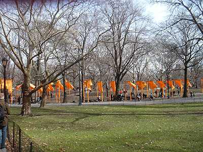
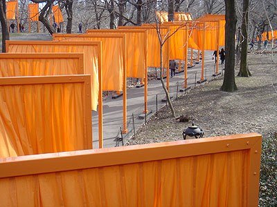
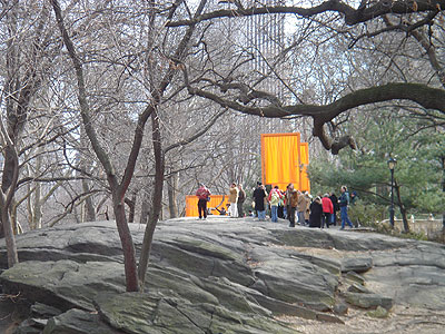
The Gates Central Park, New York City 1979-2005
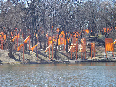
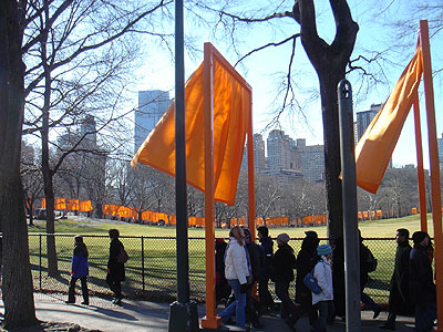
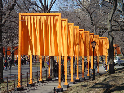
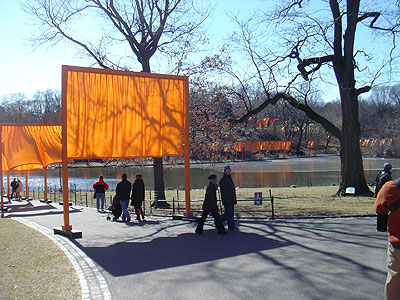
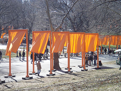
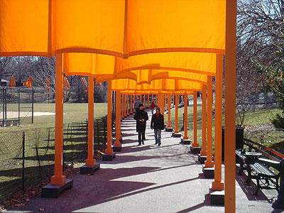
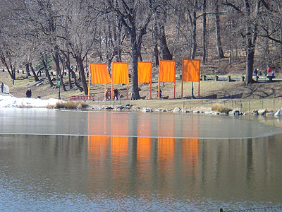
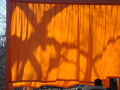
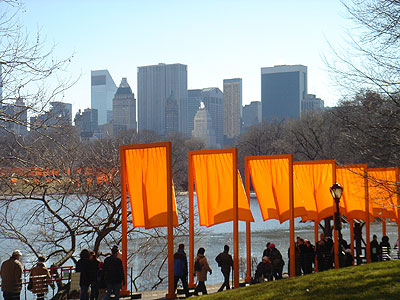
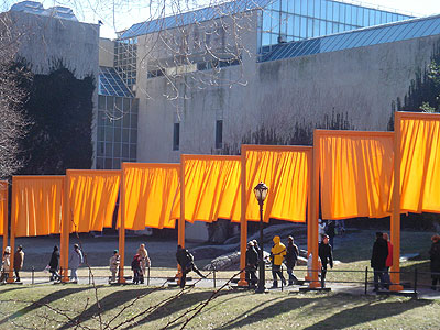
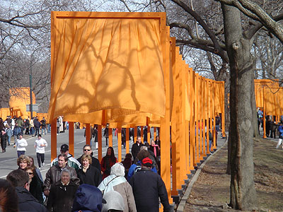
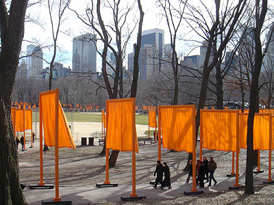
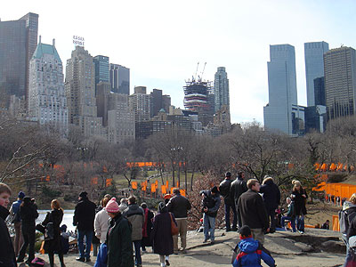
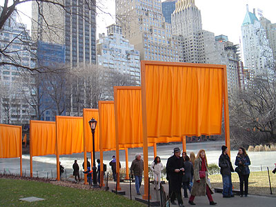
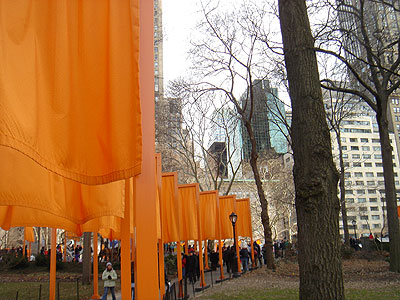
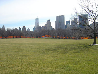
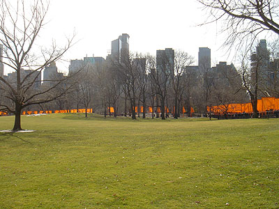
I have long been a fan of work by Christo - the wrapped structures, the running fence, umbrellas - work that is well-crafted and presents our world to us in a new package. As soon as I read about The Gates project in Central Park in 2005, I planned a trip to see them first hand.
I arrived in New York on Thursday, Febuary 17, and went that evening to the newly-reopened Museum of Modern Art to watch 3 films about the installations of earlier Christo works - Wrapped Coast in Australia, Wrapped Trees in Switzerland, and Wrapped Walkways in Kansas City.
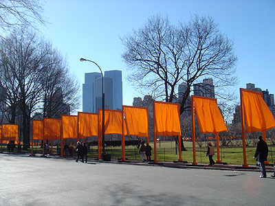
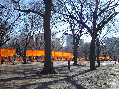
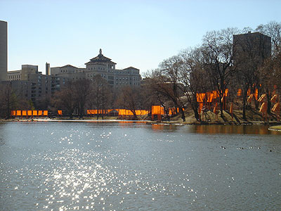
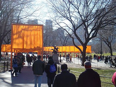
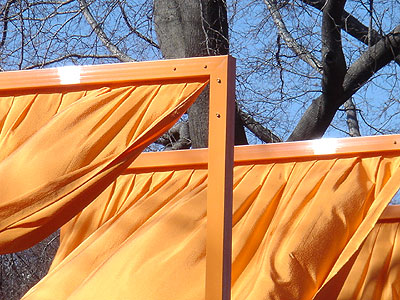
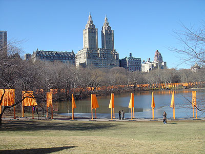
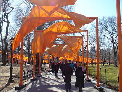
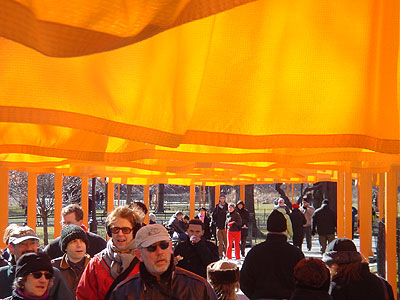
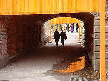
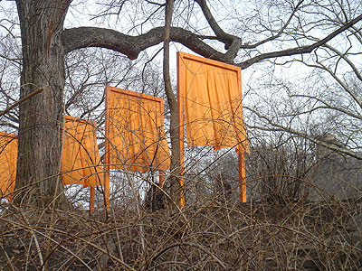
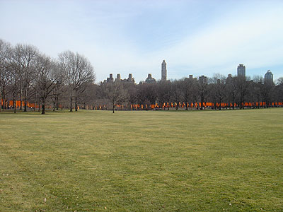
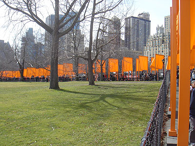
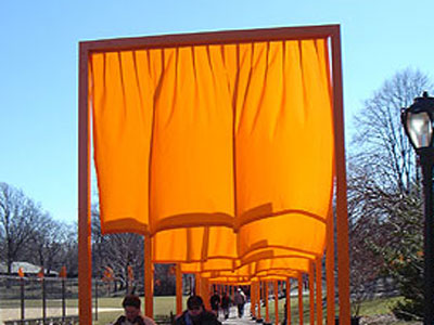
Saturday was the big day. I had previously bought bottled water, snacks, and nutrition bars. I put on my iPod, hit the Favorites playlist and rode the subway all the way up to 110th Street, the top boundary of Central Park. I walked up out of the subway entrance and saw the gates across the street. The sun was illuminating them from behind. I started to chuckle - it was so joyous. I spent the next 4+ hours wandering and zigzagging the entire length of Central Park, stopping to rest, eat, and drink when necessary. The sky was bright blue and the crowds were animated - thick at times and nonexistent at times. In addition to feeling exhilarated by the flapping orange panels, I also got to know much of Central Park - the hills, trees, brooks, lawns, and buildings. Its a spectacular park and a great otherworldly setting for this huge display of public art. At one point along the journey, I got a swatch of the orange fabric from one of the docents.
As if drawn to a magnetic focus, I returned to The Gates on Sunday - another beautiful day. This time I didn't have the goal of walking the entire length of the park so I was able to slow down and wander. I sauntered and meandered. I listened to music by Philip Glass - a very minimalist composer. His music is very repetitious which was very fitting for the repetition of the gates, the shadows, and the people. I had lunch at an outdoor cafe overlooking a meadow. There were gates blowing above me and in the distance. A great place for people watching. Both days were like a huge festival - people, food, souvenirs, picture-taking, and the stars - the gates with their fluid motion and orange color. This was a once-in-a-lifetime opportunity that I will cherish for a long time.
I was awed by several things
Details
• Dates: Saturday morning, Febuary 12, to Sunday evening, Febuary 27, 2005. The artists display their work for about two weeks. This aesthetic decision endows the work with a feeling of urgency to be seen, and the love and tenderness brought by the fact that they will not last. Those feelings are usually reserved for other temporary things such as childhood and our own lives. These are valued because we know they will not last.
• Christo Vladimirov Jovacheff of Bulgaria and Jeanne-Claude Denat de Guillebon of Morocco moved to New York City in 1964. The two have inspired the world with their public art, which has been displayed on four continents and seen by millions. Other works: Wrapped Reichstag, Berlin, 1971-95; The Pont Neuf Wrapped, Paris, 1975-85; Surrounded Islands, Biscayne Bay, Miami, 1980-83; Running Fence, Sonoma and Martin Counties, California, 1972-76, 24 miles long; and Valley Curtain, Colorado, 1970-72.
• Long wanting to do a major work in their hometown, they first proposed wrapping two buildings in the financial district downtown. That project was not approved. In addition to being impressed with the skyscrapers, they were also influenced by the amount of walking done in New York City. They wanted the new project to reflect this pedestrian river of motion and fluidity. Christo and Jeanne-Claude developed the concept in 1979. The city of New York granted permission on January 22, 2003. Christo and Jeanne-Claude took their young son to Central Park everyday - Central Park became an integral part of their lives. It is the New York City site most dependent on pedestrian activity. The gates did not interfere with any existing tree branches. All material used in the project will be recycled.
• 7,532 gates, 16 feet high, 5.5 feet to 18 feet wide, about 12 feet apart, orange fabric panels hang down 7 feet; along 23 miles of footpaths; 15,000 steel bases; 165,000 bolts and 165,000 nuts; 46 miles of hems; $21 million dollars paid by Christo and Jeanne-Claude.












Governors Island, NYC
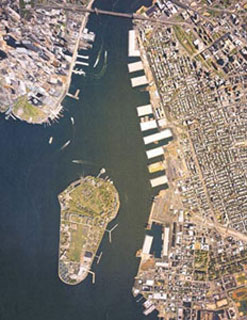

Governors Island is located in the New York Harbor, between Battery Park and Brooklyn. The island is 172 acres with nearly 225 buildings, considerable open space, and recreational amenities. Its waterfront offers some of the most dramatic and impressive vistas of the New York skyline and New York Harbor, including the Statue of Liberty and Ellis island. The northern half of the island, consisting of approximately 92 acres, has been designated as both a National Historic Landmark District and a New York City Historic District, and features late 18th and early 19th century fortifications, pre-Civil War arsenal buildings, Victorian and Romanesque Revival housing, as well as early 20th century neo-classical architecture. Five buildings within the Historic District, including Fort Jay and Castle Williams, are individually listed in the National Register of Historic Places. It recently has opened for public access and tours of the historic district.
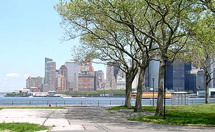
I took the ferry to the island on June 10, 2007. I spent over 2 hours wandering the beautiful tree-shaded grounds and contemplating, writing, touring buildings, and walking along the seawall for great views of the harbor, the statue, and downtown Manhattan. There were times when, while sitting on the grass, I could hear only sea gulls - no sound of the big city, even though I was right in the midst of it. A few of the buildings were open. Some of the Officer's Quarters, the old revolutionary-era fort. There were signs of history posted outside some of the major buildings. Overall, it was a very enjoyable afternoon at a unique spot in the city.
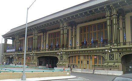


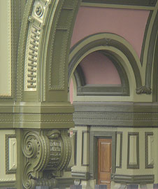

The old ferry building (new one is to the left in the bottom right foto) with its recently restored beautiful detailing.
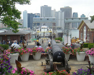
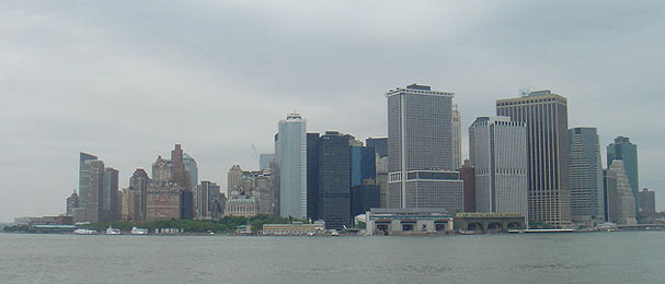

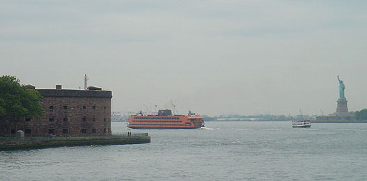
Looking over the entry cannon and the ferry landing to downtown Manhattan. The old fort Castle Williams, Staten Island ferry, and the statue.
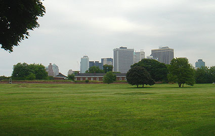
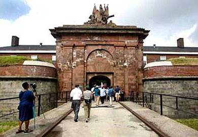

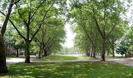
Looking over the parade ground and the old Fort Jay earthworks to the skyline beyond. Entry to the old fort. A tree-lined street within the Historic District.
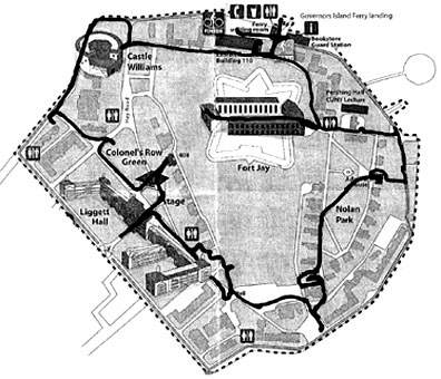
A map of the Historic District. The black line loop is my walking path.
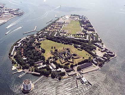
In the aerial view, Fort Jay is the star-shaped structure in the lower middle, Castle Williams is the circular building on the far right, and the triangular section towards the top is the later landfilled addition. The circular tower out in the bay at the bottom is the ventilation shaft for the Brooklyn Battery Tunnel.
Bike riding on the island
Taking a break from bicycle riding around Governor's Island on a summer day. A backdrop view of downtown Jersey City, across the Hudson River from Manhattan. June 2012

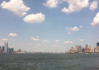
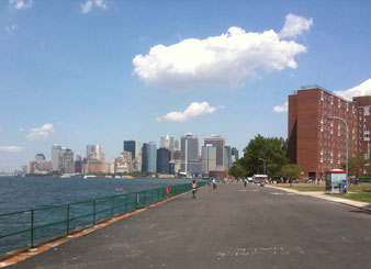
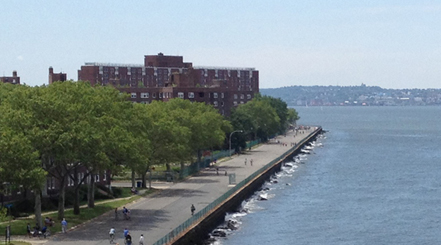
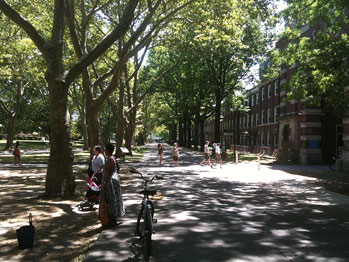
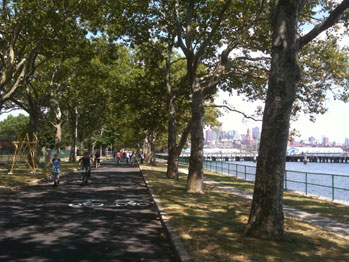
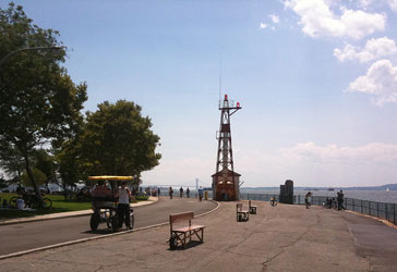
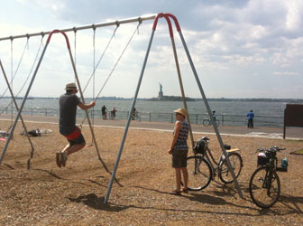
August 2010
I returned to the island. The entire southern portion had recently been opened to the public. I had just turned 60 years old and when I saw the Bike rental tent, I sat in the grass and pondered. I had not ridden bikes in Breckenridge a week earlier but thought how neat it might be. I was a bit afraid of getting back on a bike after so many decades. But, here on Governor's Island, with no cars and open asphalt, I could ride again with less fear. So, what the hell, I did. Wow. It was exhilarating. What a great place to ride - incredible views, trees and shade, and numerous fellow riders. At one point, I rested by a swing set and, again, thought, why not? So I swung like a kid.
June 2013

This time, I was able to ride a bike from my building to the ferry terminal. The white blobby sculpture above was a 'cloud' made of white plastic milk jugs and water bottles that had about an inch of blue water in each.


Lunch of a shrimp avocado mango salad and a glass of white wine. A splendid way to while away some time in the big city.


A bit of history
The Native Americans of the Manhattan region referred to the island as Pagganck (Nut island) after the island's hickory, oak, and chestnut trees. Its location made a perfect fishing camp for local tribes. In June of 1637, Wouter Van Twiller, representative of Holland, purchased Governors Island from the Native Americans of Manahatas for two axe heads, a string of beads, and a handful of nails. Though he was a representative of the Dutch Government, Van Twiller purchased the island for his private use. Known as Noten Eylant or Nutten island, it was confiscated by the Dutch Government a year later.
In 1664 the English captured New Amsterdam, renaming it New York, and took Nutten island, which had been left unfortified by the Dutch. It switched hands between the British and the Dutch over the next 10 years until the British regained exclusive control of the island for the "benefit and accommodation of His Majesty's Governors" and thus came to be called Governors Island.
The island's strategic location resulted in its use as a military facility by British and American forces for over 200 years. Following the British evacuation of New York in 1776, Americans fortified the island in fear of further advances by the British navy. When fighting broke out in August, the English overpowered General George Washington and his men, and American forces retreated from Long island and Governors Island. After the Revolution, the island reverted back to New York State, and remained inactive for several years. In 1794, with the country in need of a system of coastal defenses, construction began on Fort Jay in the center of the island. In 1800, New York transferred the island to the United States government for military purposes. Between 1806 and 1809, the Army reconstructed Fort Jay and built Castle Williams on a rocky outcropping facing the Harbor. During the War of 1812, artillery and infantry troops were concentrated on Governors Island.
During the American Civil War, it was used for recruitment and as a prison for captured Confederate soldiers. Throughout World Wars I and II, the island served as an important supply base for Army ground and air forces.
Using rocks and dirt from the excavations for the Lexington Avenue Subway, the Army Corps of Engineers supervised the deposit of 4,787,000 cubic yards of fill on the south side of Governors Island, adding 103 acres of flat, treeless land by 1912, and bringing the total acreage of the island to 172.
With the consolidation of US Military forces in 1966, the island was transferred to the Coast Guard. This was the Coast Guard's largest installation, serving both as a self-contained residential community, with an on-island population of approximately 3,500, and as a base of operations for the Atlantic Area Command and Maintenance and Logistics Command as well as the Captain of the Port of New York.
• Governors Island is a former military post, with roles in the Revolutionary War, and virtually every other major US military engagement including the War of 1812, Civil War, both World Wars, and the Gulf War; and a National Historic Landmark District featuring 18th century fortifications, pre-Civil War arsenal buildings, Victorian and Romanesque Revival housing, as well as early 20th century neo-classical architecture.
• Size: 172 acres: 92 are the Landmark District, which includes Fort Jay and Castle Williams.
• 225 Structures, of which 64 are historic.
• Sixteen acres of recreational facilities.
• One-mile esplanade for jogging and walking.
Historical events
1500s: Lenape Indians settle on island they call Pagganck (Nut island).
1624: Noten Eylant (Nutten island) is one of the Dutch West India Company's first settlements.
1637: Wouter Van Twiller, Dutch Governor of New Netherlands, privately acquires island from Native American owners, Cakapeteyno and Pehiwas, allegedly for two axe heads, a string of beads and a few nails.
1664: British take possession of the island during occupation of New Amsterdam. It remains rural, housing the Governors' sheep, cattle and coach horses.
1698: British officially acquire the island, thereafter called "Governors Island," for the "benefit and accommodation of His Majesty's Governors."
1702: Edward Hyde, Lord Cornbury, Governor of New York State, builds a "splendid" permanent home for the British governors on high ground.
1755: 51st Regiment of Foot is the first trained unit of soldiers posted on the island. Later, the unit is joined by the "Royal Americans," a British regiment recruited in America.
1776, April: Continental troops under George Washington occupy and fortify Governors Island against British invasion.
1776, September: New York City and Governors Island fall to the British.
1783: British Royal Navy surrenders the island to Governor George Clinton of New York State.
1784-1794: Unused military facilities fall into disrepair and the island is leased for a racetrack and summer resort.
1811: Castle Williams is completed and named after its designer, Jonathan Williams, the first superintendent of West Point.
1815: Peace Treaty with Britain ending the War of 1812 is celebrated with fireworks on Governors Island.
1861-1865: Civil War: Governors Island is the central Army recruiting station for the Eastern Seaboard, and Castle Williams is a prison camp, sometimes holding over 1,000 Confederate soldiers.
1870: Yellow fever epidemic rages on the island.
1901-12: By adding 4,787,000 cubic yards of fill from the Lexington Avenue Subway, the island is enlarged from 70 to 172, cost $1.1 million.
1909, September 29: Wilbur Wright takes off from Governors Island on the first flight ever over American waters, circling the Statue of Liberty before returning. A few days later he flies from the island to Grant's Tomb and back.
1914-1918: World War I island is a major supply base and embarkation point. More than 70 new buildings are erected.
1937-1938: Comedians Tommy and Dick Smothers are born at the base hospital while their father, Major Thomas Smothers, is stationed on the island.
1939-1945, World War II: The island is a major administration center and chief reception center for inductees.
1942: WAC detachment brings the island its first women soldiers.
1976, July 4: Governors Island is opened to the public for the first time, hosting 20,000 visitors for fireworks and a parade of tall ships for America's Bicentennial.
1983: Burger King opens on the island and serves beer. Other activities for officers and enlisted men include golf, tennis, swimming, bowling, bingo and movies.
1986: President Ronald Reagan relights the torch of the restored Statue of Liberty from the southwestern tip of the island.
1988, December 7: Diplomatic meetings between Ronald Reagan and Soviet leader Mikhail Gorbachev held at the Admiral's House.
1996, September 1: Coast Guard leaves Governors Island.
2001, January: President Clinton designates 22 acres, including the two great forts, as the Governors Island National Monument.
2002, April 1: The federal government sells the island to New York for one dollar.
2003, Febuary 7: Twenty-two acres of the island are transferred to the National Park Service.
Visions for the park

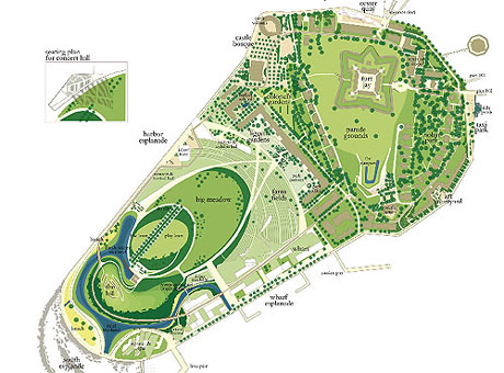
Now that the City of New York owns most of the island, the plan is to demolish all the barracks and military buildings outside the Historic District and create spaces for the public - including an amphitheater, museum, restaurants, athletic fields, nature preserves, bike trails, and walking promenades. A competition was held to solicit design ideas. 29 teams entered, 5 finalists were selected. The two above showed the most promise. Governors Island will likely become a major tourist and resident attraction in the next few years.
Maps that suggest a Hudson Ocean
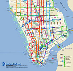
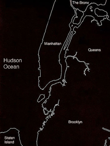
The map above left is from the New York City Metropolitan Transit Authority. It shows downtown Manhattan with the Hudson River (ocean?) on the left and the East River on the right. For some arrogant reason, New York mapmakers, especially those with the MTA, do not like to acknowledge New Jersey. But, many people in New Jersey work, shop, and party in Manhattan.
The purpose of maps is to orient us to our surroundings and guide our journeys. They should. at least, be accurate in their portrayal of the surrounding environment. City limits are no longer accurate divisions of metro areas. Metro areas include numerous towns and cities that are more accurately defined by the the television viewing area, geography, and highways.
This seems to be another example of designers not communicating efficiently to their target audience. Designers must keep in mind the end user and design for those people, not for themselves. The MTA cartographic designer was narrowly thinking of just having to show the routes within Manhattan.
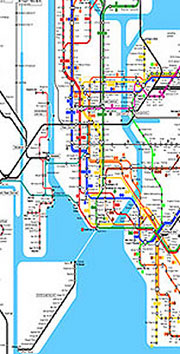

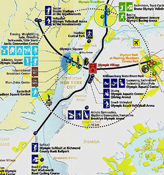
Maps that got it 'right' The maps above are a bit more accurate in that they show the proximity of New Jersey to Manhattan.
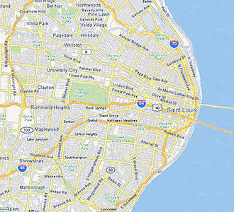
Below: If Missouri had the same disregard for Illinois as New York does for New Jersey and if the New York mapmakers were given the task of a St. Louis map, that city would miraculously be on the ocean - the Mississippi Ocean - with the downtown bridges spanning an expansive body of water.
Filming movies in New York City Summer 2006 and fall 2010
Jim Carrey in Mr. Popper's Penguins
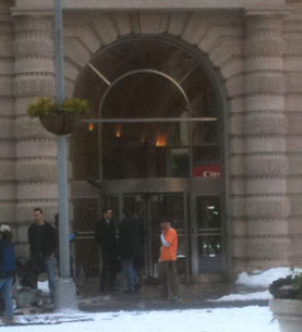
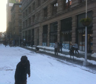
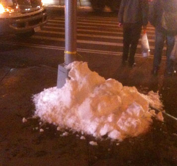
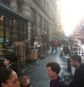
This was filmed in the fall of 2010. The weather was quite pleasant, but since the action was to take place in the winter, the production crew had to create snow and ice. Some foam pieces created drifts, plastic flakes were sprayed on large flat areas, and actual snow from a a snow-making truck was used in areas that would clearly be seen by the camera.






Disney's Enchanted
I read about this one in our local paper - downtown express. The filming would be for three nites and on the same spot where other films were shot: the Ghostbusters headquarters building; It Could Happen to You in which Nicholas Cage gave a waitress a million dollar tip; and Zoolander with Ben Stiller and a Wilson brother.
Enchanted is Disney's first feature-length film to combine live action and animation since 1988's Who Framed Roger Rabbit. It stars Patrick Dempsey (from Gray's Anatomy) as a NYC divorce lawyer who falls for a princess named Giselle (Amy Adams) who was banished from her 'magical, musical, animated land and dropped into the gritty reality of NYC' by the evil queen (Susan Sarandon). The cast also includes James Marsden as the Prince and Idina Menzel (the wicked witch in the original cast of Wicked) as the girlfriend of the attorney. The music is by the same composer who wrote the music for Wicked. The movie premiered in November, 2007. It is excellent - a clever story, good Disney characters and incredible special effects of combining the animated and live action.
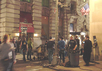
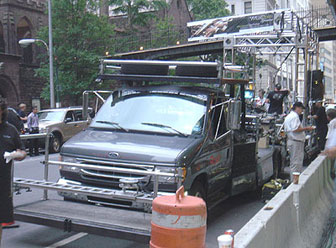
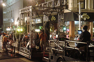
There were blocks of trucks and equipment, lights on many of the buildings, and lots of people working on the set. This one blocked traffic - cars and pedestrians - while filming short scenes. The streets were sprayed down - the scene was to take place right after it rained. The next nite would be the rainy scenes. There was a truck marked Aerial Water waiting in the next block.


Lights up on cherry picker booms. The far one (the lower of the two) also had a lightning thingy that flashed to simulate lightning - it lit up the whole area. Some of the wind fans ready for the rainy scene and a somewhat confused businessman wondering what is going on.
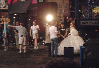
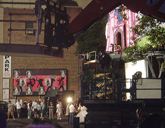
The lady in white is Amy Adams, the princess banished to NYC by the Susan Sarandon wicked witch. The iPod posters show up in the movie.


The set - a billboard for the Palace Casino, 'Where Dreams Do Come True', the princess is below the castle entrance. The princess sees the billboard and thinks it may be the way for her to get home. Another view - in the background, to the left of the bright light, is the Ghostbusters headquarters building.
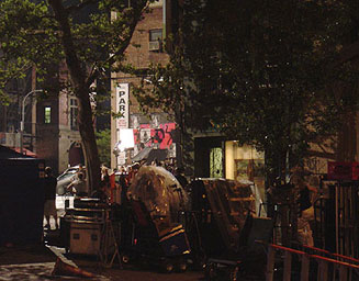
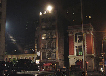

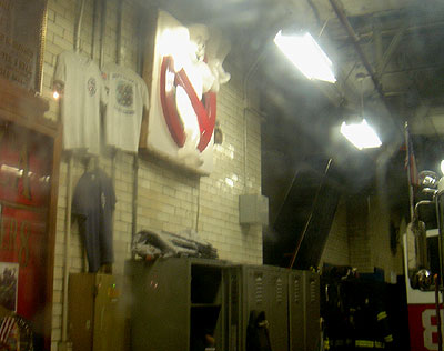
The Ghostbusters building where Dan Aykroyd, Bill Murray, Harold Ramis, Ernie Hudson, and Annie Potts worked. This is still a working fire station - the plaque to the left of the arched entrance honors the one firefighter from here who died on 9/11. The sign from the movie hangs inside.
Spiderman III
I was walking through Foley Plaza where the Federal courthouse is. That is the building with the large wide staircase that the Law & Order prosecutors walk down at the end of each episode. In the middle of the plaza was a small stage with an arch over it and a wooden banner that read, 'Thank you Spiderman'. I asked someone who looked like he should know, "Is this for the real Spiderman or just for a movie?" He stared at me for a second and let me know it was for a movie - Spiderman III. They were just now building the set; filming wouldn't begin here for another week. A few days later I noticed many cables running along the curb and that many of the buildings had stage lights on the sidewalk aimed up at the walls. I asked a guard (there are post-9/11 security guards all over the city) who mentioned it was for the Spiderman movie and pointed to the flier (film crews have to post notices in the naborhoods where they film). Filming would be that nite. Cool.
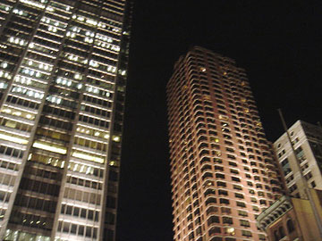
Electricians replaced the NY street lights with their own fixtures. These were custom made to fit inside the standard lights but they had a different color-corrected lamp and their own cable to the control tent. The cables were taped down the side of the pole opposite the camera. The cables entering the fixture at the top might show on camera but no one ever seems to notice or care. Every light (and there were hundreds) had its own cable to the control tent (well, groups of lights on a background building were grouped together on one dimmer).Its all about control. The lighting designer needs to be able to dim each lamp independently to provide just the right look for the film.
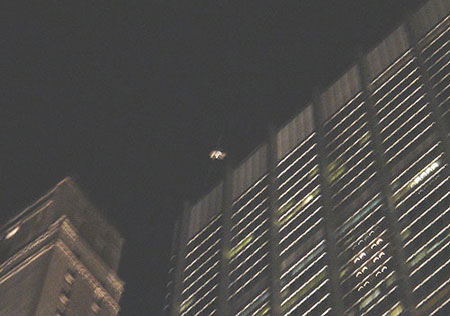
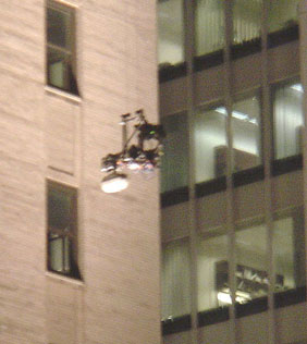
The dramatic scenes in the Spiderman movies where Toby Keith (that doesn't seem right - who plays Spiderman - isn't it Toby Keith?, its Toby somebody) swoops through the city streets are filmed by remote control. Amazing. A cable was strung between two buildings in downtown Manhattan. These buildings are about 70 stories tall and the cable stretched overhead for several blocks (I can't imagine the difficulty of the logistics of stringing up a strong cable anchored at the tops of two buildings and hoisting it up over several city blocks). From that cable a trolley could move along. From that trolley the camera was suspended on another set of cables. The camera could move up and down on that set of cables. The pictures below show some technicians working on the camera, the camera (dead center in the pic) being raised, a close-up of the camera, and the camera (the white blob) up in the sky. Under a nearby tent, several people were focused on their Apple laptops. There were laptops all over the set - the lighting tent had some, the camera control, and the people coordinating the shoot. So, the buildings were lit up for several blocks around because they would show up in the swooping scenes. The camera trolley would move along one cable and the camera would move up and down on another. This allowed the swooping motion. The camera could even be turned (for when Toby-somebody looks around) as it swoops.
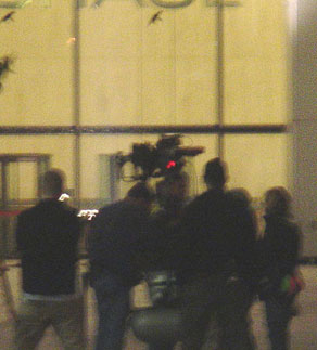
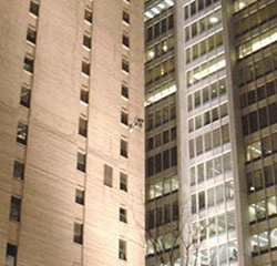
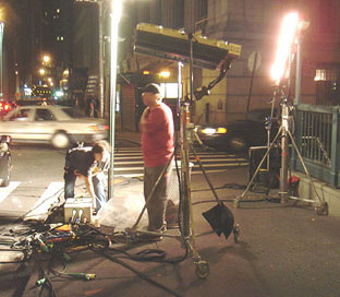
Another scene being filmed at this location was at the Constellation Restaurant (shown below) The second picture shows some of the actors waiting for their scene to be filmed. The women were talking about the latest dish on Tyra and Naomi and other models. The black drape to the left of the picture is there to block some of the light coming from the drugstore which is across the street from the Constellation. There were also taxis and other cars lined up down the street awaiting their cue. The rest of the pictures show various lighting setups, and some of the many people that were working on this set, including off-duty police and city utility people. The last picture is of the crew working the camera which is behind the guy in the red sleeves. The carts held the computers and controls to operate the camera.
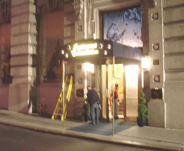
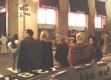
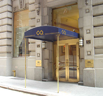

The normal city block before and after as dressed for the movie set. Set dressing elements include the awning, decorative panel over the door, name plate on either side of the door, a floor mat on the sidewalk, and a newspaper box for the Daily Bugle off frame to the left. The light fixtures had special movie lamps installed inside.
A couple of weeks later, I was walking to get lunch at Chipotle and, right there in my naberhood, was the Spiderman crew setting up again for another shoot. I took a few pix, went back with Vegas about 7p and shot a few more and then returned about 9pm.

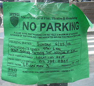

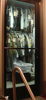
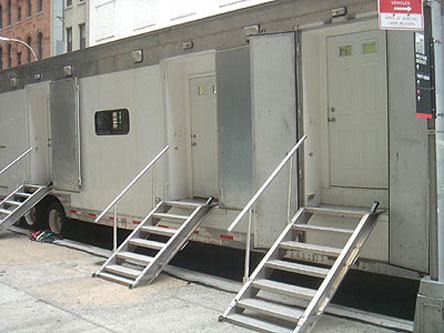
The cables that run up to the street lamp are taped on the off-camera side of the pole. A huge semitrailer full of racks of costumes and a laundry room at the back. A dressing room trailer. Notice the traditional homey doors. Several others, probably for the stars, were single use pull-out style trailers that were the size of a small apartment.
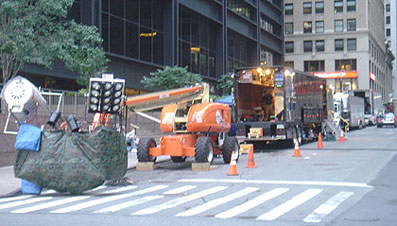

Equipment lined up next to Liberty Tower next to the WTC site. Looking towards the WTC hole.
There were trucks parked along several city blocks, equipment all over, and numerous crew people. One scene took place in a small passageway between two buildings - I couldn't see much - just the bright light emanating from the narrow walkway and the hordes of cast and crew milling about on the closed-off street. The picture below looks a lot like Tobey, the star. But its not. I talked with him later that night - he is Tobey's Personal Stand-in Assistant. He said Tobey would not be in a scene until later that night. But they broke for 'lunch' at 10pm and wouldn't film his scenes until later - I went home to bed. The pic on the right is of the director's monitors. I shot it through the window of a cafe where I had dinner.


On Church Street, a crew was gluing a fake sidewalk over the real sidewalk. The fake one matched the color and lines of the real one. The fake one contained a puddle and it was being glued over something - so I don't know if something will come through the sidewalk or they just needed a controlled reflection in the puddle.

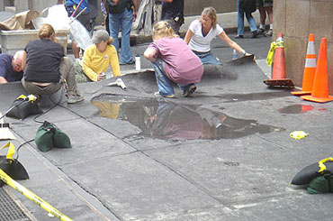
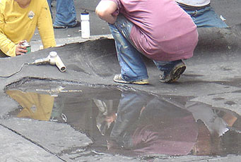
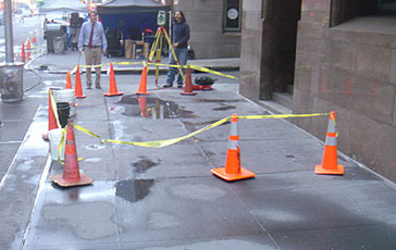
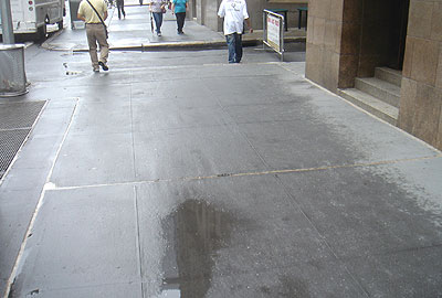
The 'normal' sidewalk, after the film crew cleaned up and left.
Another scene apparently involves a motorcycle chase in which the rider gets thrown off, blown up, crashed or something. The stunt crew was rigging a stuntman into a harness suspended from a truss on the back of a truck. In the pix below you can see the cycle seat and handlebars, the camera, and the apparatus to lift the rider off the bike.

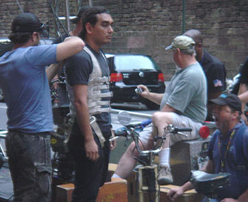

The above pictures were shot in the early evening. I suspect the stuntman here is just for a technical rehearsal - to get the timing, speed, and other details worked out. The pictures below were from the rehearsal with the whole scene later that night
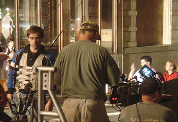
The stuntman here looks much more like Tobey. You can see the cables from his harness that will pull him up.

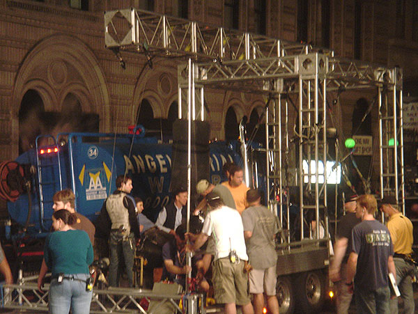
You can also see one cable going to the upper left - this one pulls off his helmet in the other direction. The guys that pull the rope down to raise the stuntman. The water truck in the background drove ahead of the camera truck to wet the streets.

This is Church Street. The back of Trinity Church (hence the name of the street) is on the left, the subway entrance is one I use a lot and I often eat at Cafe World behind the green globe on the right. My apartment building is 4 blocks to the right. The small blank building in the far background is the back of the Men In Black headquarters building.
Many cars and taxis were in the scene. I had talked to one of the drivers. They are professionals - men, women, different ages and ethnics - they got instructions from crew on the sidewalks. After each take, the entire line of cars (in both directions) would back up to their starting point. It was fascinating to watch.
The great equalizer
For one moment or two, corporate executives in polished shoes and three-piece suits stand shoulder to shoulder to someone wearing scuffed work boots and a tee-shirt. From two different backgrounds, but for a moment they share the same objective - the fastest and most efficient transportation to get where they are going. The doors open, they move apart and they go on their own expected journeys. But for that one great moment, all were one with the same immediate objective in life. They shared a common bond, probably the only time in their lives they will share such a bond. This may partly explain why New Yorkers are more tolerant and accepting of others - they share this commonality.

The subways of New York City officially opened for business at 7pm on the evening of October 27, 1904, at the City Hall station, but only after Mayor George McClellan had taken the first car on the line out for a spin, much to the chagrin of nervous IRT officials. Clifton Hood describes the scene on opening night in his 1993 book 722 Miles: The Building of the Subways: The night took on a carnival atmosphere, like New Year's Eve. Many couples celebrated in style by putting on their best clothes, going out to dinner, and then taking their first subway ride together. Some people spent the entire evening on the trains, going back and forth from 145th Street to City Hall for hours. Reveling in the sheer novelty of the underground, these riders wanted to soak up its unfamiliar sights and sensations for as long as possible. In a few instances high-spirited boys and girls took over part of a car and began singing songs, flirting, and fooling around. The sheer exuberance of opening night proved to be too much for others; although they bought their green IRT tickets and entered the stations like everyone else, these timid passengers were so overwhelmed by their new surroundings that they did not even attempt to board a train. All they could do was stand on the platform and gawk.
230 miles of track
6,200 subway cars
468 stations
31,180 entrance turnstiles
140,000 ads in the subway system
68 bridges
14 underwater tunnels
300,000 seats
169,000 people using Times Square station per week
5,800,000 average daily weekday ridership
1,499,000,000 yearly ridership
Birthday: October 27, 1904; 28 stations; 9.1 miles of track; City Hall to 145th Street.
Borough extensions: The Bronx in 1905, Brooklyn in 1908, and Queens in 1915.
Three systems merged to form the MTA (Metropolitan Transit Authority):
• IRT (Interborough Rapid Transit)
• BMT (Brooklyn Manhattan Transfer)
• Ind (Independent)
1. Tokyo: 2.863 billion riders
2. Moscow: 2.603 billion
3. New York City: 1.499 billion
4. Seoul: 1.466 billion
5. Mexico City: 1.441 billion
6. Paris: 1.373 billion
7. London: 971 million


Activities in the subway car


• Sitting in silence and observing
• Reading a book, magazine, or newspaper
• Working a Sudoku or crossword puzzle
• Listening to music on earpieces
• Talking
• Sleeping
One should not:
• Maintain unnecessary eye contact
• Peruse another's reading material
• Graze elbows or any other body parts
• Sing out loud to one's iPod
• Converse with other riders
• Leave trash on the train, take it with you
• Eat smelly foods (or anything)
• Take up more than 1 seat:


The sometimes hectic pace in the subway stations.


In 1972, New York City-based Italian designer Massimo Vignelli redesigned the New York Subway map, which persisted until 1979. There was influence from the London Underground map, created by Henry Beck in 1933. However, Vignelli took it farther, creating the now-famous intertwined wiring-diagram map of New York's vastly complicated subway lines. The result was a design solution of surprising beauty. But the level of abstraction presented problems - to make the map work graphically meant that a few geographic liberties had to be taken. Vignelli had planned a second map that would have been more tied to the actual above-ground geography, but the city never let him do it. Vignelli's beautiful and now classic map was replaced with a version that was not quite so stylized. The public couldn't quite navigate Vignelli's uncluttered version.


In late 2007, Men's Vogue magazine asked Vignelli to redesign his classic 1972 diagram and update it for 2008. Massimo and his team did just that. It was introduced in Men's Vogue in May, 2008. Still holding to the design principles, the new diagram is even clearer and less cluttered.


The map as printed in the magazine. A close-up detail.


Side-by-side comparisons: 1972. 2008. Massimo signing copies for students during the 2008 Study Tour.
Below is a map from a research project at Columbia University that shows all the mass transit for the metro area. The NYC MTA has always shunned New Jersey and the commuter railroads on their maps. A bit unreasonable since NJ makes up a sizable portion of the metro population. The metro area doesn't stop at the Hudson River. So this prototype is an improvement. This version pays respect to Vignelli's 1972 diagram with the Beck-style orthogonal lines and lack of city detail. It even shows the AirTrans routes from JFK and Newark airports to the mass transit lines.

The MetroCard


The old days of nickel rides (now its $2.50) and tokens are long gone. With new technology, these credit card sized plastic cards have become the new way to enter a turnstile at a subway station. When I get to New York, I buy an unlimited ride MetroCard for a week or a month. There are 3 subway lines within a few blocks of my apartment and several more a few blocks beyond those (the lines converge towards the tip of Manhattan.) I started collecting expired MetroCards - I built three vertical sculptural columns from 735 recycled MetroCards collected over a period of several months. The cards take on a new life - from utilitarian access to aesthetic repetition. I have gotten into the habit of grabbing the expired cards that have been left in the stations. I don't know what to do with them. I checked at the Transit Center in Grand Central to see if the cards could be reused or recycled. They said no, they're just thrown away. Seems a waste so I'll probably continue to collect them. As of March, 2008, I had collected an additional 2,000 MetroCards that are waiting for some new life or new use.
Free subway rides?
From an article in New York magazine, 2007
Theodore Kheel thinks we've waited long enough for a transportation revolution - the 93-year-old labor lawyer has a plan: double the tolls on the bridges and tunnels, and the subways and buses would be free. Kheel first floated his idea in 1965. Kheel's Nurture New York's Nature Foundation has subsidized a $100,000 study by a group endearingly called the Institute for Rational Urban Mobility. An early look of its scheme reveals that inbound drivers would be charged $16, about what Londoners pay now. About 20 percent of drivers would then opt to leave their cars at home. The remaining tolls would more than replace the $2 fare we now pay. Fare-collection costs - now 6 percent of the MTA budget - would be diverted into handling the huge swell in ridership. “This is one of the major issues of our time. Right now, I've never seen the automobile traffic as dense as it is, and the cost of that is tremendous. We're not going to tell people not to ride automobiles; we're simply going to say you ought to pay your share."
Advertising in the cars and stations
There have been ads in the subway cars for decades - its a great source of revenue for the MTA. Advertisers can buy an entire car or one side - so their messages will dominate the environment. The fotos below show a clever campaign for the Bronx Zoo that dominated this car. The ads look like there is a zoo ad next to an ad for a legitimate retailer (like a book store, cheese shop, or tuxedo rental). Characters from the zoo ad are intervening in the fake retail ad.


Ads for Target were all over the Union Square/14th Street Station - a hip young area with several converging lines. Some ads are in traditional framed spots, others were on vinyl and adhered to the steel beams. I counted about 40 separate ads and I probably didn't see them all. And - get this - there isn't even a Target store in Manhattan (although I suspect there will soon be).
Public Art in subway stations
Public art in the NYC subway stations is a very old tradition. Decorative elements in the stations originally were designed to reflect the naberhood above. Canal Street with Chinese characters, Fulton's steamship at Fulton Street, kinetic sculpture and reclaimed original mosaic tile art at Unions Square, etc.
NRW trains • Prince Street
The frieze at the Prince Street subway station celebrates the significance and individuality of the citizens of New York. It depicts 194 silhouetted people, taken from photographs of New Yorkers in all their variety, arranged as a 1200 foot narrative that contains smaller dramatic narratives within it. More than two thousand New Yorkers were photographed walking along the street - 194 were selected as the most evocative, varied, and visually readable. For the installation, some of the existing white subway tiles were removed and replaced with new identical tiles that had been cut out in the shape of the figures. Stainless steel, marble, and slate shapes were placed in those spaces like puzzle pieces, making it appear that the figures are embedded in the walls. The title, "Carrying On", refers to the figures carrying various objects; New Yorkers carrying on with their lives after 9/11, and the "notoriously opinionated and lively" New Yorkers who "really do carry on."
Title: Carrying On
Date: 2003
Artists: Janet Zweig with Edward del Rosario
Materials: water-jet cut stainless steel, marble, terrazzo, slate


6 train • Astor Place station
Astor Place has two works of art - the original station identifying tiles show a beaver (John Jacob Astor began his fortune in beaver pelts) shown in the upper rite of the first foto below. Later, Milton Glaser created artwork that complements the existing historic fabric while making a bold and modern statement. Glaser described his approach as, "basically a variation on the existing forms. By extracting fragments of the motifs on the tile panels, enlarging their scale, and placing these pieces in a random pattern, they take on the appearance of a puzzle."The result is a series of porcelain enamel panels in geometric patterns and color that echo the historic elements but present them in an entirely new way. Milton Glaser went to school at Cooper Union which is above this station.
Title: Untitled
Date: 1986
Artist: Milton Glaser
Material: Porcelain enamel on platform walls


NR train • 23rd Street
From the 1880s through the 1920s, 23rd Street was a major vaudeville, entertainment, and cultural district, and "Ladies Mile," the fashion and department store haven of the time, was located nearby. Keith Godard represents the area through the various hats they might have worn. The celebrities he had in mind include Jim Brady, Oscar Wilde, Sara Bernhardt, Mark Twain, and Lillian Russell. Godard says, "In addition to bringing back memories of the specific time period and people and appealing to the viewers on a more common level as fascinating hats, this design can also serve as an interactive, playful, and witty landmark." The hats are at the approximate height of the figure and labeled with text beneath.
Title: Memories of Twenty-Third Street
Date: 2002
Artist: Keith Godard
Material: Glass mosaic on platform walls


Panorama view. The hat for Samuel Clemens, Mark Twain.

ACE trains • 14th Street
The scores of figures created by Tom Otterness invigorate and transform the transit environment into a place of joy and whimsy. His small-scale sculptures invoke the subway and lore of the city and include an alligator rising out of a sewer to devour a man, workers carrying oversize versions of the tools used to build the subways, and people sneaking under fences to watch the construction or sweep up piles of pennies. There are also colossal feet and a totem-like sculpture whose human features are formed into the shape of a telephone. Otterness placed his creations in unexpected places-beneath stairs and pillars, hanging from the ceiling, and on benches and railings-to surprise and delight riders as they come upon these humorous and captivating inhabitants.
Title: Life Underground
Date: 2001
Artist: Tom Otterness
Material: Bronze sculpture on railings, beams, and columns throughout station


123SNRQW trains • Times Square
Lichtenstein is famous for his enlargements of a comic-book-dot style of outrageous moments in life. This project, begun in 1994, includes icons of a futuristic Manhattan.
Title: Times Square Mural
Date: 2002
Artist: Roy Lichtenstein
Material: 16 panels, porcelain enamel on steel, 6' x 53'


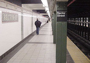
A pair of shoes that match but neither person saw the other's shoes and they didn't know each other. I have become fascinated with the variety of shoes I see in the subway. There are probably some interesting stories behind or inside most of them.
A tile art conundrum: I notice that text in the older tiles have a border around the letters in the same colors as the background. Some of the newer ones have the rows of background tiles butt right up to the letterforms.


Going to a Yankees game 6:00-11:00p, Monday, May 21, 2007
A friend, Michael, was in town for a few days. He's a baseball fanatic - we tried to get tickets to a Yankee game but, according to their website, they were sold out (except for the $250-$400 seats). So, to satisfy our desire, we booked a tour of the stadium. Incredibly cool. We saw the press box, the field, the honor courtyard, and the Yankees dugout. Our tour guide was an older fan who was very loyal to 'his boys'. The Yankees are the quintessential baseball team. The honor court reads like a who's who of baseball. The Yankees have won 26 World Championships - the second place team, Boston, has won only 10.
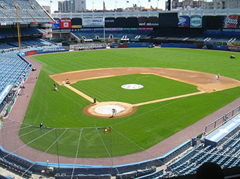
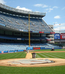
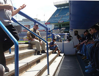
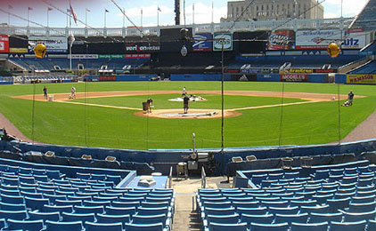
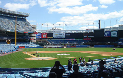
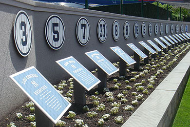

After we toured the empty stadium, we checked at the box office - there were a few seats that might be behind the foul ball pole (they weren't). We bought them. We went back into the city and walked around SoHo. Then back to Yankee Stadium for the game. Fuck, what a hoot (Yankees fans say fuck a lot). This was an incredible experience. The Yankees were playing their rivals, the Boston Red Sox, or, as the many signs said and the fans continually shouted - Boston Sucks.
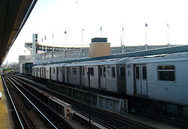
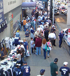
Arriving at the stadium by subway. A shot of the fans along the street before the game.

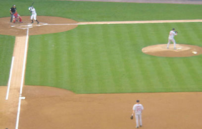
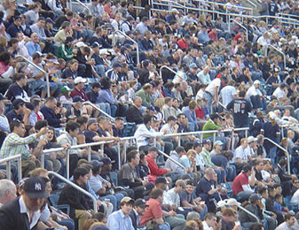
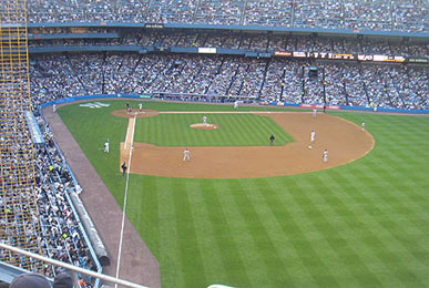
The stands are filling up - these are real fans - there were over 700 police officers assigned to the game - 120 inside the stadium. A-Rod gets up to bat and, on the first swing, hits a home run. We also saw Derek Jeter.
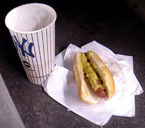
I had decided during the stadium tour that morning that, during the game, I would get a hot dog and a beer. That was dinner. I had been looking forward to it all day. It didn't disappoint. One of the best meals I've ever had. Damn, just thinking about it makes me want to go back for another meal. The foto below right is of a father and son. A home run ball came a few rows in front of us and this man fought and won - he got the ball. He immediately lobbed it to his son who was also in the mix trying for the ball. I snapped the foto a few minutes later of the proud papa and son.

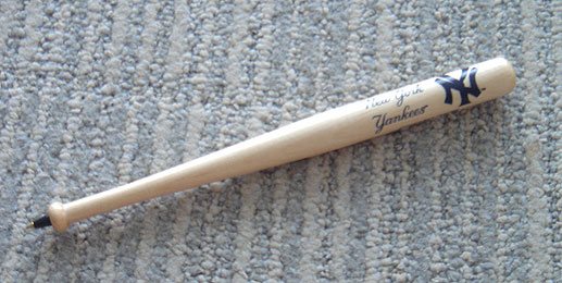
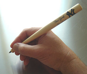
My bat souvenir Before and after the game, I checked lots of concession stands inside and outside the stadium - I was looking for a small bat. In 1961, my father took his sons to a Yankees game. I was 10 years old. I saw this small wooden bat pen and asked dad to buy it for me. He did. I cherished that little bat. I really wanted to get one in 2007 - 46 years later. I finally found one at the NY Yankees Gift Shop in Lower Manhattan, not far from my apartment.
The shot below on the right is of the walk from the stadium back to the subway station, under the elevated tracks. This image has been in my memory since 1961 - not sure why - I just remember dad, my brother, and I making that same walk. So, I took the foto from about where I remembered it from 46 years earlier. In my memory, there were less people which suggests that dad had taken us out of the game earlier to get us back to the hotel - mom was probably worried about us being up in the Bronx. In 1961, Battery Park City where I now live, was still a row of old piers - no parks, buildings, World Trade Center, marina - nothing was there in 1961 but the old freight piers.

The West Thames Pedestrian Bridge over West Street
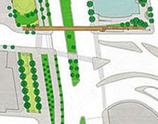
The intersection of West Thames and West Street connects the NYC Financial District to Battery Park City. This is also where the Brooklyn Battery tunnel empties into Manhattan. Here are 3 pedestrian crossing options:
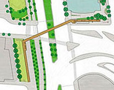

In June of 2009, a 21-million-dollar pedestrian bridge at the intersection of West Thames and West Street connecting the Financial District to Battery Park City was announced.
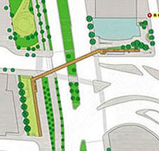
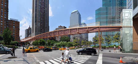
The bridge has 3 angled sections with an elevator and ramp at one end, and stairs & ramp at the other. This plan:
• Adds to the literal and visual chaos of the intersection.
• Requires the removal of an entire row of trees.
• Removes shade from one side of the dog park.
• Does not integrate into the order and alignment of the naborhood.

Above: Elevation of the bridge ramp and staircase along the dog park. Below: The row of trees that will be cut down.
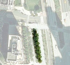
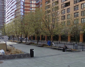
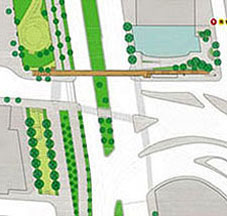
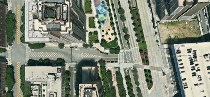
In this more obvious and intuitive solution, the bridge goes straight across West Street and terminates with an elevator and a staircase on the west and an elevator and ramp or stair/ramp on the east. A few advantages:
• While it may seem hard to integrate the philosophies of organic architecture in an urban setting, the existing sidewalk locations, dimensions, and curves look custom made for the western landing to be on the north side of Thames Street. That side better respects and maintains the fabric of the naborhood by integrating the bridge with the alignment of the existing street and building grid.
• The new bridge will serve the residential buildings along Rector Place, South End Avenue, Thames, and Battery Place. Residents farther south will likely use the crosswalk at Battery Place or 2nd Place/Morris Street. As residents from Rector Place and West Thames walk to the financial district or to the subways along Rector Street, many will not have to cross Thames Street.
• The distance of the bridge span would be as short as feasible, thus requiring less material.
Option 2 would be the most convenient for the most people, fit the site better by respecting the existing grid and alignment, enhance the naborhood aesthetics and quality of life, maintain the most existing trees, and be more cost efficient.


This option acknowledges that crossing the intersection, with barriers, stoplights, crossing guards and a nearby police presence is quite safe and convenient. The State Department of Transportation has added some traffic-calming features, including colored crosswalks, more than 500 trees in the median, additional time for pedestrians to cross, countdown signals, and reducing the speed limit from 35 miles per hour to 30.
• The city cannot guarantee anyone's safety. People should take responsibility for their safety - making smart decisions at busy intersections. They should guide and set an example for their children.
• The intersection is already quite safe - traffic signals with Walk and Don't Walk signals, concrete and stone barrier walls, protected median landing, landscaping, recently funded crossing guards, and police officers within a few yards. There is no evidence that the intersection of West Street and Thames is dangerous.
• With or without the bridge, school kids have to cross a street before they get home. This particular intersection is quite safe for any person taking responsibility and paying attention to the signals.
• This option would save the city millions of dollars.
6 years later: Proposal #2

The 2009 proposal never got adequate funding, went through a lengthy public design review, and hit some bureaucratic and design snags. The snags were finally resolved and a new proposal was presented in 2014. The revised West Thames bridge is a 240-foot-long concrete and steel structure with a glass roof and is expected to cost $27.5 million (not including any certain-to-come overcharges). It will be accessible by stairs and elevators on each end. With no ramp along the dog park, fewer trees will have to be removed. As of November 2015, ground has not been broken for the bridge. The project has been stalled by arguments over which agency will absorb any cost overruns. The most recent official estimates are that construction will begin on the West Thames pedestrian bridge sometime in 2016, with no projected completion date yet announced.


Above left: In 2015, the canopy over the staircase was deleted. Below left: Proposed layout. Right: Option that is cheaper, requires removal of fewer trees, better respects the urban grid, is visually more appealing, and provides a more convenient walking option.


New brand name for Lower Manhattan
Manhattanites have established identities thru their naberhoods - SoHo, Lower East Side, etc. These names help define and locate areas within the diverse and conglomerated city. Some areas are named after a prominent landmark (Times Square, Rockefeller Center), or an area (Upper West Side, Murray Hill), or an industry (Fashion/Garment District, or an ethnic concentration (Little Italy, Chinatown), or acronyms that encompass several identifying marks (SoHo, TriBeCa).
Examples of some acronym brands
NoHo: North of Houston Street
SoHo: South of Houston Street (no relationship to the older Soho in London)
TriBeCa: Triangle below Canal Street
NoLIta: North of Little Italy or North Little Italy
LoDo is the lower downtown area of Denver, Colorado. A historic district known for its shopping and nightlife, it serves as an example of the success of urban renewal.
The downtown area
Lower Manhattan, until recently, was very commercial - lots of offices but not much residential. Since pumping in post-9/11 money, the nature of the area is changing. Office buildings are being converted into condominiums and retail and restaurant growth is booming. New museums and cultural centers are being built or are proposed. The naberhood is establishing a new feeling of excitement and enthusiasm.
So, this part of Manhattan needs a brand - an identifying name. Current reference names include Downtown, Financial District, Battery Park City, and Lower Manhattan. But those names don't quite work. Downtown is too vague - some New Yorkers say anything south of 14th Street is downtown, others say it is south of Canal Street. Financial District referred to the area that was primarily commercial/corporate. That area is changing rapidly to more residential and Financial District now sounds a bit too cold and corporate for a residential naberhood. Battery Park City is often confused with Battery Park and designates a specific sliver of landfill west of the city proper jutting into the Hudson River.
Lower Manhattan is already used and recognized by some - the Lower Manhattan Development Corporation was created to guide the rebuilding of the area after 9/11. There's even a website: http://www.LowerManhattan.info
From an article in the New York Post - in the years since 9/11, aggressive building and selling has doubled the residency. In 2000, the area east of Broadway south of City Hall house 19,000 - that figure is projected to boom to 65,000, a boom so far unmatched in Manhattan. But Lower Manhattan doesn't have a distinct association - so far, its used for corporate and distribution of information. So, while Lower Manhattan has some name recognition, thereby minimizing the education process for a new name, it is not quite sexy nor memorable enough. We need a short catchy name.
Proposed brand: LoMa
Reducing Lower Manhattan to the first syllables (as in SoHo and TriBeCa) gives us the name LoMa. This designation is easy to say, write, and remember.
Here's a fun twist - in Spanish, the word loma means hill and, in the local native American Indian dialect, Manhattan means land of hills. Nice connection.
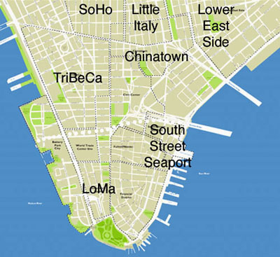
LoMa, the area below the white dotted line on the map, would include the area south of Vesey Street and the WTC site (TriBeCa now comes that far south), City Hall, and the Brooklyn Bridge. It would include Battery Park City and the Financial District, but not the South Street Seaport area which is now trying to establish its own new identity and brand. Specific boundaries would probably remain somewhat vague as developers position and market their buildings in certain identified and branded naberhoods. It seems there is a need for a moniker to clarify the areas downtown. We'll see which one wins out and joins the New York vernacular. Concept: Summer, 2006


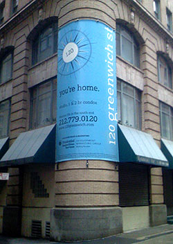
New table cards for MoMA's Cafe2
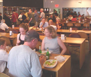
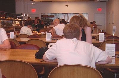
One afternoon in the fall of 2005, I was at the Museum of Modern Art, hereafter referred to as MoMA. I had ordered lunch in Cafe2 (its the cafe on the 2nd floor) and went and sat next to an older woman. As we were waiting for our food to arrive, we got to talking about the food delivery system, hereafter referred to as FDS.
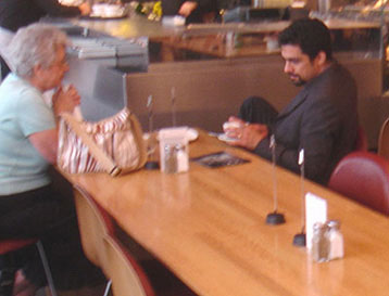
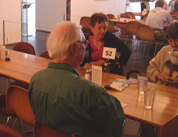
An explanation of the MoMA FDS
The host hands you a card that explains the procedure at Cafe2. After you order at the counter, the cashier hands you a laminated card with a number on it and she (they were all women) types that number into your order on the machine. Once you find a seat, you are supposed to place your numbered card into the alligator clip mounted at the top of a wire stand. Guys (they were all men) later pick up the order and check the ticket for the number that the cashier typed in. The guys then have to scan the entire room until they find the card with the number that they seek.
Okay, back to the story: This woman wisely suggested that they could color code the numbers. Brilliant idea. I told her so. She flushed a bit and we discussed it a bit further, enjoyed our lunch, then parted ways amicably.
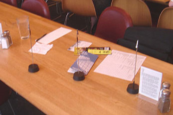
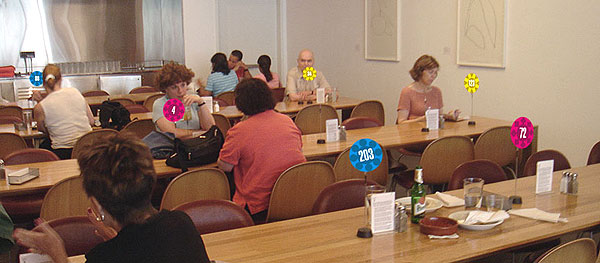
A few months later, Sean and I are sitting in about the same area in the same cafe. I told Sean about the discussion I had with the lady. We further refined the concept - 3 or 4 different colors. And different shapes. Color coding the numbers and using different shapes would reduce the amount of cards the guys would have to scan. If the guy was looking for 'Red round 44' he would only have to peruse the round red cards until he found number 44. Also, Cafe2 at MoMA was very minimally furnished - simple tables and chairs, white walls with white framed white art on them. We felt the splashes of accent colors on the table tops would add a nice aesthetic touch to the space. Especially since it was in a museum. We made a few sketches and notes (our work space shown at left). Sean took some pictures and we refined our notes and the images over the next few weeks.
Design concept
The proposed new FDS consists of colorful unique floral shapes that uniquely denote food order numbers and provide an innovative and fun aesthetic element within Cafe2 at MoMA.
The new cards also serve as 'centerpieces' on the table. Centerpieces remind us of having guests over, decorating the table, and providing a special sense of comfort and care for our guests. The floral shapes offset the rigid geometry of the architectural features in the space and become, themselves, abstract works of art - art that is functional and enhances the Cafe2 dining experience.

Some of Sean's rough sketches of the cards. On the left - flowers and shapes. On the right - refined roughs of all flowers.

Objectives/criteria/advantages
The proposed FDS table cards:
1. Enhance the efficiency of delivery of food. It is easier and quicker to spot a particular number. The basic concept already in place with black & white, is now carried even further.
2. Add a fun layer of aesthetics to the cafe. The spots of colors and shapes become focal points that help unify the room and provide a sense of whimsy and fun for the tired and hungry museumgoer.
3. Continue to show how MoMA pays attention to detail and impresses the visitor with innovative graphics and systems for operation. The proposed solution meets the objectives of improving the FDS and adding a fun element of focal aesthetics to the museum cafe.
Sean designed a leave-behind presentation that included diagrams, sample cards, sketches, and thorough rationale.
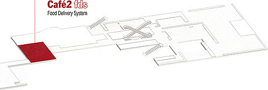
In addition to improving the efficiency of the FDS and enhancing the aesthetics of the space, the new shapes offset the rigid geometry of the architectural features in the cafe and become themselves, abstract works of art - art that is functional and enhances the dining experience for the MoMA guest.
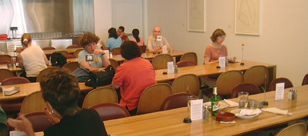
Above: the existing FDS in Cafe2. Below, the proposed FDS in Cafe2.
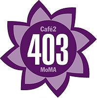

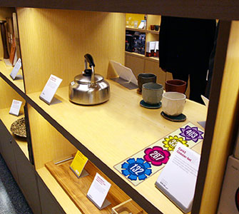
The new shapes and colors used in Cafe2 lend themselves appropriately to a set of coasters that can be sold in the MoMA Design Store. The museum visitor can now take a bit of their experience home with them. Each flower shape has the additional copy of Cafe2 and MoMA to help reinforce the brand image of the museum. The coasters are sold in a flat pack of 4. The simple clear package allows the coasters and MoMA brand to be easily seen while sitting on the shelf in the store. Shoppers can buy multiple sets if they need more than 4 coasters.
Concept refinements, notes, sketches and fotos: July 2006
Preparation of submission packet: September & October 2006
Submission to MoMA: October 20, 2006

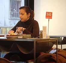
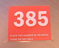
Cafe2 was remodeled in November of 2006. A visit after it reopened showed that they are now using three colors - black, white, and red. Each card has instructions printed on it.

In 2009, I noticed a new pattern on the napkins - these geometric shapes would be perfect on the table cards. These patterns were designed by Ivan Chermayeff in the 1960s for use on sugar packets at the MoMA Cafe. The three basic chspaes - circle, square, triangle - would be perfect for the table cards.
The slightly blurry foto below is of brgr, an excellent hamburger restaurant on 7th Avenue in NYC that uses a similar system of colored flag cards.

40th anniversary visit to Woodstock
In August 1969, one of the most celebrated music festivals in history took place at a time when Americans were deeply divided. Over 400,000 people from across the country gathered to celebrate "Three Days of Peace and Music." The three days of legendary performances, unimaginable mud, and unforgettable experiences helped the Woodstock Music and Art Fair become a symbol of an entire generation.
I saw the original Woodstock movie in 1970 at the Gemini drive-in theater in Dallas. We sat outside on our cars - almost, but not quite - like we were at the festival. I was between semesters at UT Austin. Austin was so similar to the attitudes, music, and spirit of Woodstock, that I felt a special connection with the event in New York. In 2009 I watched the new release of the Director's Cut of the Woodstock movie. Again, I was taken back to that wonderful time of my life. But now, I was in Manhattan, 2 hours away from the site. A museum had opened a year before, so I decided to make the pilgrimage to the site and the museum. Above is the map of the new Bethel Woods Center for the Arts. It includes a new amphitheater and the Woodstock Museum.
So, Friday morning, July 3 2009, after walking the dogs I took the subway up to get my car from its garage. Then on the road. I was listening to a 1969 playlist on my iPod and drinking Starbucks coffee in my power-windowed vehicle. None of which existed in 1969. But I was trying to put myself in the mood of that era. I drove straight to the site and, instead of starting at the museum, went to the monument overlooking the stage (in the upper left corner of the map above). A bearded guy was sitting under an awning. Serving as guide/docent, he had photos from 1969 on a table and we talked about the festival. He was there and helped work at several locations. He shared great insight and pointed out the main sights to me - the stage, the performer's tent, the helipad, first aid, camping, and the food tents. I walked down into the bowl and onto the flat area where the stage was. Then I drove back up the hill to the museum. There, I enjoyed the exhibits and films, had lunch, and took more drugs (coffee).
Woodstock festival
• August 15-17, 1969
• Location: White Lake/Bethel NY, after Woodstock (venue not large enough) and Wallkill (town said no)
• Name: An Aquarian Exposition, the Woodstock Music and Art Fair
• Slogan: 3 days of peace and music
• The community was not prepared for the crowds that began arriving. By Thursday, August 14, much of the area had become an enormous traffic jam.
• The festival officially began just after 5p on Friday, August 15, 1969, and that day's events ended shortly after 2am the next day.
• On Saturday, August 16, the festival began at noon and ended after The Who played a 24 song set that started at 3a.
• Jimi Hendrix played what many consider to be the festival highlight, on Monday, August 18, when only 35,000 people - a small fraction of the crowd - remained.
• Some residents did not embrace the crowds, yet others welcomed the visitors, supplying them with free food and water when it was apparent that Food For Love, the festival concessionaire, was not prepared to feed the massive crowd that gathered. The Hog Farm commune of New Mexico, hired to build a campsite on the grounds for attendees, opened the Free Kitchen serving macrobiotic, vegetarian meals.
• First aid at the festival was provided by the Woodstock medical crew in a field hospital located near the stage. The team tended minor accidents, food poisoning and an epidemic of cut feet since so many were going barefoot.
• Museum website
• Great website of photos and detailed history
• List of bands and their playlists
• Aerial photos: Barry Z Levine, copyright 1969


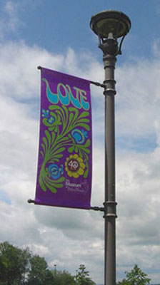
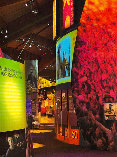
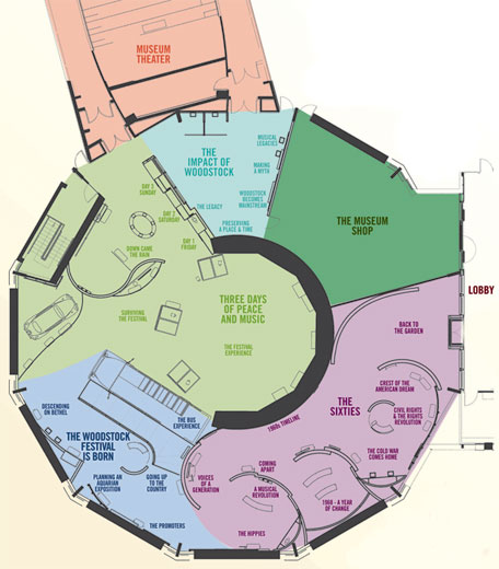
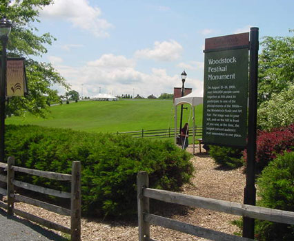
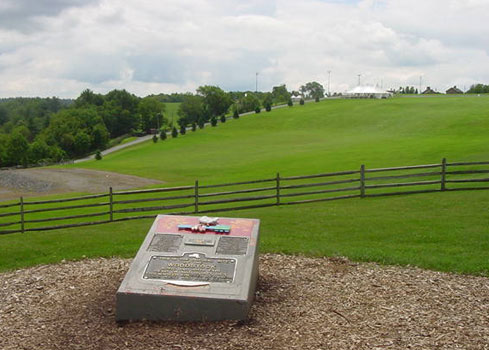
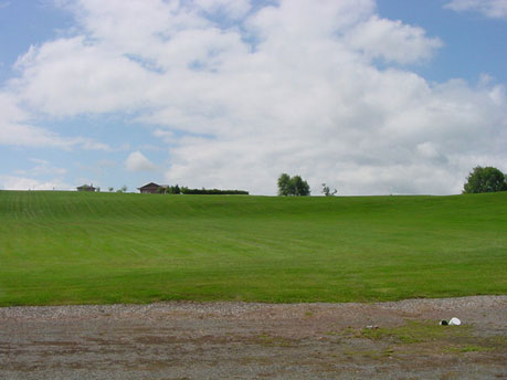
Monument overlooking the site of the stage and the bowl seating. The seating area from the stage.
Below: Friday afternoon, August 15, 1969 and Friday afternoon, July 3, 2009.

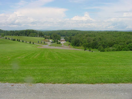
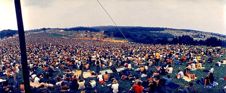
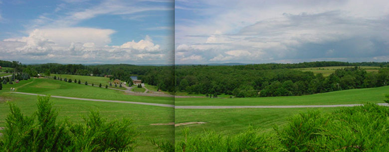

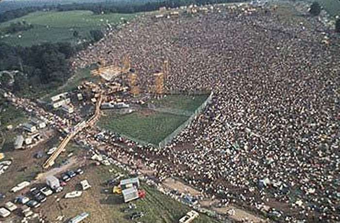
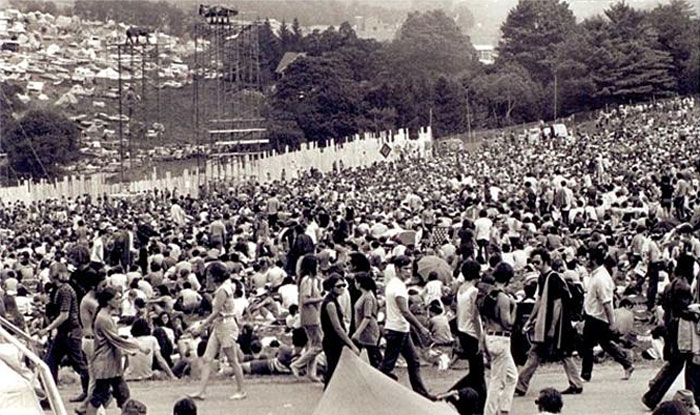
A better seating arrangement on the plaza at Lincoln Center
Lincoln Center in New York City is a campus of 12 performing arts and educational organizations. The main entry to the entire campus is the open public space with its central Revson Fountain set into a distinctive patterned pavement designed by Philip Johnson. The Plaza pavement masonry has recently been renovated, and the Fountain enhanced with new lighting and technical upgrades.
On the plaza are two seasonal food carts and a seating area. The arrangement, however, of the seating area and its surrounding fence ignore the patterns and lines of the plaza and the fountain.
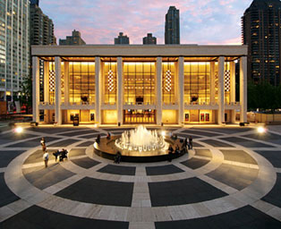
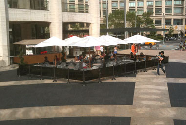
Above: Views looking south and northeast from the fountain.
Below: Looking east towards Broadway and looking west towards the fountain.
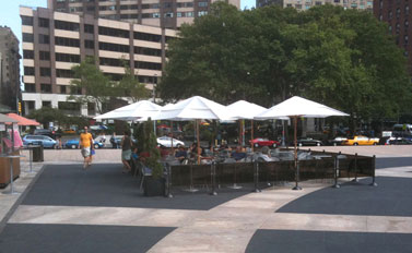

Design objectives
• Integrate elements to enhance the overall environment.
• Respect and emphasize existing architectural elements.
• Empathize with the user and with the pedestrian point of view.
A better layout would be to align the fence barrier with the dominant patterns in the plaza. The umbrellas could be aligned on the gird formed by the surrounding buildings, thereby integrating the seating area to both the plaza and the buildings. The proposed arrangement allows the Philip Johnson-designed plaza to maintain its original design integrity.
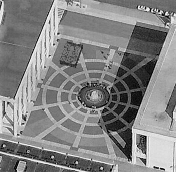
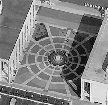
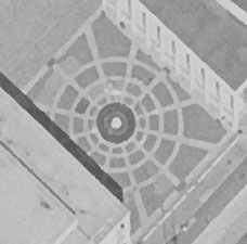


Taking the stairs
The New York Walk - New Yorkers can't look down and walk or they'll run into somebody; we can't look ahead because we'll trip over something. So, we have developed this very alert way of looking down, looking ahead, and side to side - being very aware of our surroundings so we can smoothly fit into the flow of human inertia.
Clarification: Not all natives and very few tourists have mastered the New York Walk. Sometimes the sidewalk flow can be a bit chaotic.
There's a new movement in public health and ecology: encourage people to increase their stair-climbing activities. New York City issued a set of “active design guidelines" aimed at increasing stair use. “If we engineered physicality out of our lives, we can engineer it right back in." Stair-climbing is a more efficient form of exercise than walking:
• 2 additional minutes of stair-climbing per day (approximately 3 floors) can burn enough calories to eliminate the average adult's annual weight gain.
• There is a 33% difference, according to a Harvard study, in mortality rates between men who climbed more than 55 flights of stairs a week and those who didn't.
I often see people waiting on an elevator just to go one floor or two. One really shouldn't take an elevator if only going up or down 1 floor (unless physically unable or carrying packages, etc). It doesn't make much sense to use the time and electricity to move a human up 10 feet when that same person can easily (and usually faster) walk the 10 feet up. Are we really so lazy that we need to be powered up a floor or two? In September 2008, I saw this green sign in New York City serving to educate people to not use the electricity. This sign provides a personal benefit - burning calories. At a time when so many Americans are overweight, that's a pretty good benefit. There has been a 67% rise in stair use at a ten-story middle-income housing complex in the Bronx after the city started posting these signs.
Cooper Union's new academic building features luminous, centrally located stairs - and an elevator that stops on only three of the building's nine stories. It's not the first building to feature a “skip-stop" elevator; elevators at Baruch College's Newman Library and housing in Yonkers are similar. The idea was originally popularized by Le Corbusier in the 1920s to save space by eliminating elevator landings.
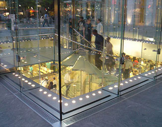
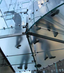
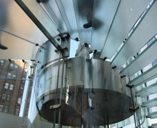
Some Apple Stores (Fifth Avenue shown above) feature a glass stairway, “I've never seen anyone use the elevator." says an employee in SoHo. Stairwells at a housing project in the Bronx feature glass doors, and those at the Bronx Library Center have windows and an art installation. Other businesses put artwork on stairs and landings.

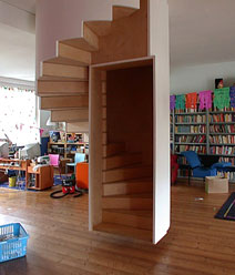

Longchamp store in SoHo (more below). Suspended spiral stair. Alternating step stair.
Buildings can discourage elevator use just by making elevators smaller and slower, tactics New York City recommends “especially in low-rise buildings." These tactics are called “the naughty strategy."
Elevator trivia
• The first elevator shaft was designed in 1853 for the original Cooper Union.
• At the New York World's Fair in 1854, Elisha Otis demonstrated his new safety elevator.
• A steam-powered Otis elevator was first installed in 1857 at 488 Broadway in SoHo (a city landmark, it's still there in working condition).
• Number of elevators in New York City: 54,806
• Number of elevator trips per day in NYC: 30 million
An incredible staircase in SoHo
Longchamp, a women's accessory store established in Paris in 1948, opened a store in New York City's SoHo in a 1936 building at the corner of Spring and Greene streets. Because they had a small street level storefront, they told the architect, Thomas Heatherwick of London (isn't Thomas Heatherwick a great English name?) to make an entry so intriguing that people would want to climb to the second floor. He succeeded.


The undulating steel plates (55 tons of steel) and linoleum inserts form a spectacular entrance. The ribbon-like forms cascade down through the skylit core, dividing and converging; making a topography of walkways, landings, and steps.
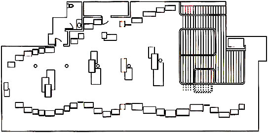
Entrance level, door at bottom of diagram. Second level sales floor (the third level is for buyers and vendors only).
The stairway railings are bent plexiglas that undulate and drape as fabric might. The display shelves are strips of plywood that have been peeled down from the ceiling - each veneer layer of ply peels up to form a shelf. The frames in the bathroom are integrated with molding - a morphing of images, frames, and wall.
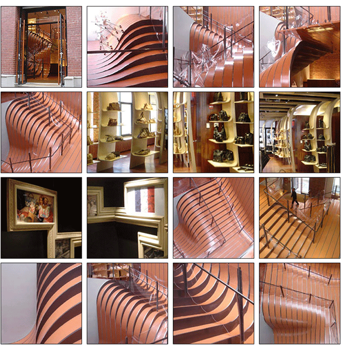
GuideMaps: New York City
Created for student Study Tours, including streets, landmarks, design sights, and subway entrances.
